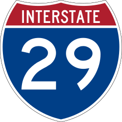
Interstate 29
| Interstate 29 | |
| Interstate 29 | |
 | |
 | |
| Längd | 1216 km |
|---|---|
| Byggd | Okänt |
| Södra änden | |
| Huvudavfarter | |
| Norra änden | MB 29 vid den kanadensiska gränsen i närheten av Pembina |
Interstate 29 eller I-29 är en väg, Interstate Highway, i norra centrala USA. Den går ifrån Kansas City, Missouri till den Kanadensiska gränsen. Den mäter 1 216 km.
Delstater vägen går igenom
Externa länkar
 Wikimedia Commons har media som rör Interstate 29.
| |||||||
Media som används på denna webbplats
Uses the Roadgeek 2005 fonts. (United States law does not permit the copyrighting of typeface designs, and the fonts are meant to be copies of a U.S. Government-produced work anyway.) Colors are from [1] (Pantone Red 187 and Blue 294), converted to RGB by [2]. The outside border has a width of 1 (1 mm) and a color of black so it shows up; in reality, signs have no outside border.
Uses the Roadgeek 2005 fonts. (United States law does not permit the copyrighting of typeface designs, and the fonts are meant to be copies of a U.S. Government-produced work anyway.) Colors are from [1] (Pantone Red 187 and Blue 294), converted to RGB by [2]. The outside border has a width of 1 (1 mm) and a color of black so it shows up; in reality, signs have no outside border.
600 mm by 600 mm (24 in by 24 in) Interstate shield, made to the specifications of the 2004 edition of Standard Highway Signs (sign M1-1). Uses the Roadgeek 2005 fonts. (United States law does not permit the copyrighting of typeface designs, and the fonts are meant to be copies of a U.S. Government-produced work anyway.) Colors are from [1] (Pantone Red 187 and Blue 294), converted to RGB by [2]. The outside border has a width of 1 (1 mm) and a color of black so it shows up; in reality, signs have no outside border.


