Impfondo
| Impfondo | |
| Desbordesville, Imponfo | |
| Stad | |
| Land | |
|---|---|
| Departement | Likouala |
| Koordinater | 1°37′05″N 18°03′35″Ö / 1.61804°N 18.05981°Ö |
| Area | 104,3 km²[1] |
| Folkmängd | 47 719 (2018)[2] |
| Befolkningstäthet | 458 invånare/km² |
| Tidszon | WAT (UTC+1) |
| Geonames | 2259655 |
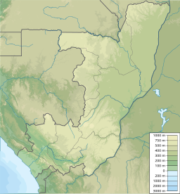
Impfondo är en stad (franska: commune) i Kongo-Brazzaville.[3] Den är huvudort i departementet Likouala, i den nordöstra delen av landet, 700 km norr om huvudstaden Brazzaville. Antalet invånare är 47 719.[2]
Källor
- Annuaire statistique du Congo 2018. Brazzaville: Institut national de la statistique. 2020. https://ins-congo.org/annuaire-statistique/
Noter
- ^ ”Loi n° 13-2017 du 16 mars 2017 portant érection de certaines communautés urbaines en communes” (på franska). Journal officiel de la république du Congo (Brazzaville) 59 (12): sid. 332–334. 2017. https://www.sgg.cg/JO/2017/congo-jo-2017-12.pdf. Läst 14 oktober 2021.
- ^ [a b] Annuaire statistique, Chapitre 6 : Statistiques demographiques. sid. 7
- ^ Annuaire statistique, Chapitre 3 : Organisation administrative. sid. 13
Media som används på denna webbplats
Shiny red button/marker widget. Used to mark the location of something such as a tourist attraction.
Författare/Upphovsman: Urutseg, Licens: CC0
Map of the Republic of the Congo, parameters equivalent to File:Congo location map.svg


