Imperial County
| Imperial County | |||
| County | |||
| |||
| Land | |||
|---|---|---|---|
| Delstat | |||
| Huvudort | El Centro | ||
| Area | 11 608 km² (2010)[1] | ||
| - land | 10 817 km² (93%) | ||
| - vatten | 790 km² (7%) | ||
| Folkmängd | 174 528 (2010)[2] | ||
| Befolkningstäthet | 16 invånare/km² | ||
| Grundat | 7 augusti 1907 | ||
| Tidszon | PST (UTC-8) | ||
| - sommartid | PDT (UTC-7) | ||
| FIPS-kod | 06025 | ||
| Geonames | 5359067 | ||
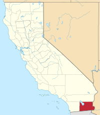
 Läge i delstaten Kalifornien. | |||
Delstatens läge i USA. | |||
| Webbplats: https://www.co.imperial.ca.us/ | |||
Imperial County är ett administrativt område (county) i delstaten Kalifornien, USA. År 2010 hade Imperial County 174 528 invånare. Den administrativa huvudorten (county seat) är El Centro.
Geografi
Enligt United States Census Bureau har countyt en total area på 11 608 km². 10 812 km² av den arean är land och 795 km² är vatten.
Befolkningstätheten är ca 13 invånare per kvadratkilometer. Countyt utgör ett eget Metropolitan statistical area med El Centro:s urban area som kärnområde.
Angränsande countyn
- Riverside County, Kalifornien - nord
- Yuma County, Arizona - sydost
- La Paz County, Arizona - nordost
- San Diego County, Kalifornien - väst
- gränsar till Mexiko i söder och sydväst
Orter
- Brawley
- Calexico
- Calipatria
- El Centro (huvudort)
- Holtville
- Imperial
- Westmorland
Se även
Källor
- ^ ”2010 Census U.S. Gazetteer Files for Counties”. U.S. Census Bureau. Arkiverad från originalet den 5 juli 2012. https://www.webcitation.org/68vYLbou5?url=http://www.census.gov/geo/www/gazetteer/files/Gaz_counties_national.txt. Läst 5 juli 2012.
- ^ ”State & County QuickFacts, Imperial County, Kalifornien” (på engelska). U.S. Census Bureau. Arkiverad från originalet den 11 juli 2011. https://www.webcitation.org/606oKKmJH?url=http://quickfacts.census.gov/qfd/states/06/06025.html. Läst 6 juli 2011.
Externa länkar
 Wikimedia Commons har media som rör Imperial County.

| ||||||||||
|
Media som används på denna webbplats
Astronaut photo of the Algodones Dunes, at the borders of California, Arizona, and Mexico. The All-American Canal cuts across the southern end of the dunes and the Cargo Muchacho Mountains can be seen beneath cloud cover at the top of the scene. Remains of the Alamo Canal are located parallel to the left side of the Colorado River (center far right of image), with the intake still visible near Pilot Knob.
Författare/Upphovsman: Huebi, Licens: CC BY 2.0
Map of USA with California highlighted
Flag of California. This version is designed to accurately depict the standard print of the bear as well as adhere to the official flag code regarding the size, position and proportion of the bear, the colors of the flag, and the position and size of the star.
Seal of Imperial County, California


