Hyde Park, New York
| Hyde Park | |
| town | |
(c) Daniel Case, CC BY-SA 3.0 Top Cottage | |
| Land | |
|---|---|
| Delstat | New York |
| County | Dutchess County |
| Höjdläge | 73 m ö.h. |
| Koordinater | 41°47′5″N 73°55′59″V / 41.78472°N 73.93306°V |
| Yta | 103 km² (2010) |
| - land | 95 km² |
| - vatten | 8 km² |
| Folkmängd | 21 571 (2010) |
| Befolkningstäthet | 227 invånare/km² |
| Tidszon | EST (UTC-5) |
| - sommartid | EDT (UTC-4) |
| ZIP-kod | 12538 |
| Riktnummer | 845 |
| FIPS | 3637209 |
| Geonames | 5121724 |
(c) NordNordWest, CC BY 3.0 Ortens läge i delstaten New York | |
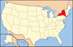
New Yorks läge i USA | |
| Webbplats: hydeparkny.us | |
Hyde Park är en kommun (town) i Dutchess County i den amerikanska delstaten New York med en yta av 103 km² och en befolkning som uppgår till 21 571 (2010).[1]
I kommunen föddes Franklin D. Roosevelt, amerikansk president 1933–1945.[2] Hans hem Springwood är i dag ett museum, Home of Franklin D. Roosevelt National Historic Site.[3]
Referenser
- ^ Hyde Park town, Dutchess County, New York. US Boundary. Läst 2 juni 2017.
- ^ FDR Biography. FDR Library. Läst 2 juni 2017.
- ^ Home of Franklin D. Roosevelt. National Park Service. Läst 2 juni 2017.
Media som används på denna webbplats
Shiny red button/marker widget. Used to mark the location of something such as a tourist attraction.
Författare/Upphovsman: Huebi, Licens: CC BY 2.0
Map of USA with New York highlighted
(c) NordNordWest, CC BY 3.0
Location map of the State of New York, USA
(c) Daniel Case, CC BY-SA 3.0
Top Cottage, one of the first fully disabled-accessible buildings in the United States, built by Franklin D. Roosevelt as a retreat in Hyde Park, NY. A National Historic Landmark


