Hunter River, New South Wales
| Hunter River | |
| Vattendrag | |
Lastbåt på väg in i Hunters mynning | |
| Land | |
|---|---|
| Delstat | New South Wales |
| Mynning | Tasmanhavet |
| - koordinater | 32°55′07″S 151°47′32″Ö / 32.91861°S 151.79222°Ö |
| Tidszon | AEST (UTC+10) |
| - sommartid | AEDT (UTC+11) |
| Geonames | 2162901 |
Hunter River är en av de större floderna i New South Wales i Australien. Den rinner upp i bergskedjan Liverpool och rinner först i sydlig riktning för att sedan böja av mot öster och rinna ut i Tasmanhavet vid Newcastle, New South Wales, som är den andra största staden i New South Wales och har en viktig hamn. Den nedre delen av flodfåran formar ett öppet och vindpinat deltaområde.
Galleri
Media som används på denna webbplats
Shiny red button/marker widget. Used to mark the location of something such as a tourist attraction.
Författare/Upphovsman: , Licens: CC BY-SA 3.0
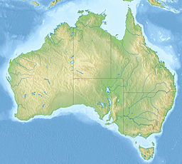
Relief map of Australia, including the borders of the states of the Commonwealth of Australia
Bulk carrier Nicole entering Newcastle Harbour. Image was taken at the shore end of the Stockton breakwall on Shipwreck walk
Confluence of the Hunter and Williams rivers at Raymond Terrace, New South Wales. The image was taken from under the Fitzgerald Bridge over the Williams River, just east of where the rivers join. The Hunter river flows out of frame and towards Newcastle at the left of the image.
Flooding of the Hunter and Williams Rivers in Nelsons Plains during 2007. This view is from Seaham Road, looking to the (roughly) west.
Newcastle CBD from Stockton
Författare/Upphovsman: Conquimbo, Licens: CC BY-SA 3.0
Bridges across Hunter River in Tarro, NSW. Although known as the "Hexham bridges" only the southern approaches are in Hexham. The bridges themselves are in the suburb of Tarro.


