Hultasjön (Hinneryds socken, Småland)
not parsed now - please come back in a few minutesMedia som används på denna webbplats
Författare/Upphovsman: Silverkey (Mickaël Delcey), Licens: CC BY-SA 4.0
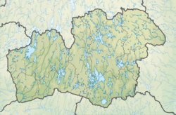
Location map of Kronoberg in Sweden. N-S stretching is 183%, geographic limits of the map:
- N: 57.30 N
- S: 56.30 N
- W: 13.20 E
- E: 16.00 E
Shiny red button/marker widget. Used to mark the location of something such as a tourist attraction.
Författare/Upphovsman: Mikadiou, Licens: CC BY-SA 3.0
opened laptop computer, brown screen


