Hoveyzeh (shahrestan)
| Den här artikeln har skapats av Lsjbot, ett program (en robot) för automatisk redigering. (2016-09) Artikeln kan innehålla fakta- eller språkfel, eller ett märkligt urval av fakta, källor eller bilder. Mallen kan avlägsnas efter en kontroll av innehållet (vidare information) |
| Hoveyzeh (شهرستان هويزه) | |
| Shahrestān-e Hoveyzeh, هويزه | |
| delprovins | |
| Land | |
|---|---|
| Provins | Khuzestan |
| Huvudort | Hoveyzeh |
| Höjdläge | 8 m ö.h. |
| Koordinater | 31°18′N 47°54′Ö / 31.3°N 47.9°Ö |
| Folkmängd | 38 886 (2016)[1] |
| Tidszon | IRST (UTC+3:30) |
| - sommartid | IRDT (UTC+4:30) |
| Geonames | 9532924 |
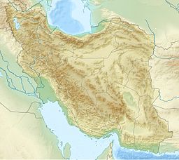
Läge i Iran | |
Hoveyzeh (persiska: شهرستان هويزه, هويزه) är en delprovins (shahrestan) i Iran.[2] Den ligger i provinsen Khuzestan, i den västra delen av landet, 600 km sydväst om huvudstaden Teheran.
Delprovinsen hade 38 886 invånare 2016.[1]
Källor
- ^ [a b] Population and Household of the Country by Province and Sub-province (Shahrestan), Statistical Center of Iran (SCI). Tillgänglig på Iran Data Portal. Läst 15 februari 2023.
- ^ Hoveyzeh hos Geonames.org (cc-by); post uppdaterad 2014-09-08; databasdump nerladdad 2016-08-15
Media som används på denna webbplats
Robot icon
Flag of Iran. The tricolor flag was introduced in 1906, but after the Islamic Revolution of 1979 the Arabic words 'Allahu akbar' ('God is great'), written in the Kufic script of the Qur'an and repeated 22 times, were added to the red and green strips where they border the white central strip and in the middle is the emblem of Iran (which is a stylized Persian alphabet of the Arabic word Allah ("God")).
The official ISIRI standard (translation at FotW) gives two slightly different methods of construction for the flag: a compass-and-straightedge construction used for File:Flag of Iran (official).svg, and a "simplified" construction sheet with rational numbers used for this file.
Författare/Upphovsman: Uwe Dedering, Licens: CC BY-SA 3.0
Topographic map of the Iranian plateau in Central Asia, connecting to Anatolia in the west and Hindu Kush and Himalaya in the east.
Shiny red button/marker widget. Used to mark the location of something such as a tourist attraction.


