Hopkinton, Rhode Island
| Hopkinton, Rhode Island | |
| Kommun (town) | |
| Land | |
|---|---|
| Delstat | |
| County | Washington County |
| Höjdläge | 53 m ö.h. |
| Koordinater | 41°27′40″N 71°46′39″V / 41.46111°N 71.77750°V |
| Area | 8,59 km²[1] |
| Folkmängd | 8 398 (2020)[2] |
| Befolkningstäthet | 978 invånare/km² |
| Tidszon | EST (UTC-5) |
| - sommartid | EDT (UTC-4) |
| ZIP-kod | 02800–02899, 2800, 2804, 2809, 2810, 2812, 2817, 2823, 2825, 2830, 2833, 2839, 2842, 2848, 2851, 2853, 2856, 2857, 2858, 2864, 2869, 2870, 2874, 2878, 2879, 2881, 2885, 2886, 2892, 2897 och 2899 |
| Riktnummer | 401 |
| GNIS-kod | 1220092 |
| Geonames | 5222680 |
Översiktskarta | |
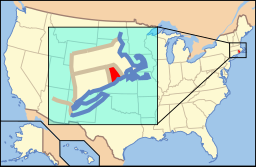
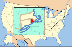
Rhode Islands läge i USA | |
| Wikimedia Commons: Hopkinton, Rhode Island | |
| Webbplats: http://www.hopkintonri.org | |
| Redigera Wikidata | |
Hopkinton är en kommun (town) i Washington County i delkommunen Rhode Island, USA med cirka 7 836 invånare (2000). Den har enligt United States Census Bureau en area på 114,3 km².

Referenser
- ^ United States Census Bureau, 2016 U.S. Gazetteer Files, United States Census Bureau, 2016.[källa från Wikidata]
- ^ United States Census Bureau (red.), USA:s folkräkning 2020, läs online, läst: 1 januari 2022.[källa från Wikidata]
| ||||||||||
Media som används på denna webbplats
Författare/Upphovsman: This version: uploader
Base versions this one is derived from: originally created by en:User:Wapcaplet, Licens: CC BY 2.0
Map of USA with Rhode Island highlighted
Författare/Upphovsman: John Phelan, Licens: CC BY-SA 3.0
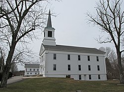
First Seventh Day Baptist Church of Hopkinton, Ashaway Rhode Island
(c) Swampyank på engelska Wikipedia, CC BY-SA 3.0
This is my 2008 photo of Hopkinton City Historic District in Rhode Island.


