Hooper Bay
| Hooper Bay | |
| Stad (city) | |
Hooper Bay med vindkraftverk i bakgrunden | |
| Land | |
|---|---|
| Delstat | |
| Borough | Unorganized Borough |
| Höjdläge | 8 m ö.h. |
| Koordinater | 61°31′44″N 166°6′26″V / 61.52889°N 166.10722°V |
| Area | 22,13 km² (2010)[1] |
| - land | 21,29 km² (2010) |
| - vatten | 0,84 km² (2010) |
| Folkmängd | 1 375 (2020)[2] |
| Befolkningstäthet | 65 invånare/km² |
| Grundad | 7 februari 1966 |
| Tidszon | AST (UTC-9) |
| - sommartid | ADT (UTC-8) |
| ZIP-kod | 99604 |
| Riktnummer | 907 |
| GNIS-kod | 1403493 |
| Geonames | 5864197 |
Ortens läge i delstaten | |
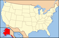
Alaskas läge i USA | |
| Wikimedia Commons: Hooper Bay, Alaska | |
| Redigera Wikidata | |
Hooper Bay är en ort (city) i Kusilvak Census Area i delstaten Alaska i USA. Orten hade 1 093 invånare, på en yta av 22,13 km² (2010).[3]
Referenser
- ^ United States Census Bureau, 2010 U.S. Gazetteer Files, United States Census Bureau, 2010, läst: 9 juli 2020.[källa från Wikidata]
- ^ United States Census Bureau (red.), USA:s folkräkning 2020, läs online, läst: 1 januari 2022.[källa från Wikidata]
- ^ ”Gazetteer Files – 2010” (på amerikansk engelska). The United States Census Bureau. https://www.census.gov/geographies/reference-files/time-series/geo/gazetteer-files.2010.html. Läst 9 augusti 2021.
Externa länkar
 Wikimedia Commons har media som rör Hooper Bay.
Media som används på denna webbplats
Shiny red button/marker widget. Used to mark the location of something such as a tourist attraction.
Författare/Upphovsman: Alexrk2, Licens: CC BY 3.0
Location map of Alaska, USA
Equirectangular projection, N/S stretching 210.0 %. Geographic limits of the map:
- N: 72.0° N
- S: 51.0° N
- W: 172.0° E
- E: 129.0° W
Författare/Upphovsman: Huebi, Licens: CC BY 2.0
Map of USA with Alaska highlighted


