Holyoke
| Holyoke | |||
| Stad (city) | |||
| |||
| Land | |||
|---|---|---|---|
| Delstat | |||
| County | Hampden County | ||
| Höjdläge | 61 m ö.h. | ||
| Koordinater | 42°12′15″N 72°37′5″V / 42.20417°N 72.61806°V | ||
| Högsta punkt | Mount Tom[1] | ||
| - höjdläge | 366 m ö.h. | ||
| - koordinater | 42°14′30″N 72°38′53″V / 42.24167°N 72.64806°V | ||
| Area | 59,14 km² (2010)[4] | ||
| Folkmängd | 38 238 (2020)[5] | ||
| Befolkningstäthet | 647 invånare/km² | ||
| Grundad | 1850[2] | ||
| Borgmästare | Joshua A. Garcia (2021–)[3] | ||
| Tidszon | EST (UTC-5) | ||
| - sommartid | EDT (UTC-4) | ||
| ZIP-kod | 01040 och 01041 | ||
| Riktnummer | 413 | ||
| GNIS-kod | 617679 | ||
| Geonames | 4939783 | ||
Översiktskarta | |||
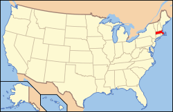
Massachusetts läge i USA | |||
| Wikimedia Commons: Holyoke, Massachusetts | |||
| Webbplats: http://www.holyoke.org/ | |||
| Redigera Wikidata | |||
Holyoke är en stad i Hampden County, Massachusetts, USA. Den hade 39 838 invånare vid folkräkningen år 2000.
Staden är platsen där volleyboll som modern idrott föddes. Detta skedde 1895, då idrottsläraren William G. Morgan uppfann ett bollspel som han då kallade mintonette.[6]
Referenser
- ^ hämtat från: engelskspråkiga Wikipedia.[källa från Wikidata]
- ^ hämtat från: engelskspråkiga Wikipedia.[källa från Wikidata]
- ^ läs online, www.holyoke.org , läst: 3 april 2023.[källa från Wikidata]
- ^ United States Census Bureau, 2010 U.S. Gazetteer Files, United States Census Bureau, 2010, läst: 9 juli 2020.[källa från Wikidata]
- ^ United States Census Bureau (red.), USA:s folkräkning 2020, läs online, läst: 1 januari 2022.[källa från Wikidata]
- ^ volleyboll i Nationalencyklopedins nätupplaga. Läst 4 september 2017.
Externa länkar
 Wikimedia Commons har media som rör Holyoke.
- Holyokes stad
| ||||||||||
|
Media som används på denna webbplats
Författare/Upphovsman: Simtropolitan, Licens: CC BY-SA 3.0
The skyline of Holyoke, Massachusetts, as seen from Chicopee, in the background the Mount Tom Range is visible, specifically Whiting Peak (left) and Mount Nonotuck (right). In the foreground Holyoke City Hall is visible, along with the Smith Building to its left, and the Caledonia Building to its right.
Författare/Upphovsman: Simtropolitan, based on other works by Rcsprinter123, Licens: CC BY 3.0
Map showing the location of this city within Hampden County, Massachusetts. Data source: 2010 U.S. census
Författare/Upphovsman: This version: uploader
Base versions this one is derived from: originally created by en:User:Wapcaplet, Licens: CC BY 2.0
Map of USA with Massachusetts highlighted
Flag of the City of Holyoke, Massachusetts, featuring a simplified version of its municipal seal, shown in royal purple with its name emblazoned around it. Holyoke's purple and white colors seem to originate before the First World War, with a September 1914 South Holyoke Lyceum gala being hosted in a City Hall Grand Ballroom decked out with purple and white banners and clusters of so-colored lights, and it also appeared as the 1919 color scheme of Holyoke High School's yearbook.
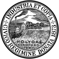
The seal of the City of Holyoke, a symbol representing the collective municipal government, featuring two mills alongside the Holyoke Dam, and Mount Tom prominently in the background behind a grove of trees by Log Pond.


