Hohenems
| Hohenems | ||
| Stadskommun | ||
Hohenems | ||
| ||
| Land | ||
|---|---|---|
| Förbundsland | Vorarlberg | |
| Distrikt | Dornbirn | |
| Höjdläge | 432 m ö.h. | |
| Koordinater | 47°21′50″N 09°41′21″Ö / 47.36389°N 9.68917°Ö | |
| Area | 29,17 km²[1] | |
| Folkmängd | 17 239 (1 januari 2023)[2] | |
| Befolkningstäthet | 591 invånare/km² | |
| Borgmästare | Dieter Egger (FPÖ) | |
| Tidszon | CET (UTC+1) | |
| - sommartid | CEST (UTC+2) | |
| Postnummer | 6845 | |
| Riktnummer | 05576 | |
| Kommunkod | 80302 | |
| Geonames | 7873739 | |
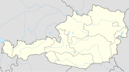
(c) Karte: NordNordWest, Lizenz: Creative Commons by-sa-3.0 de Stadens läge i Österrike | ||
Kommunens läge i distriktet Dornbirn | ||
| Webbplats: www.hohenems.at | ||
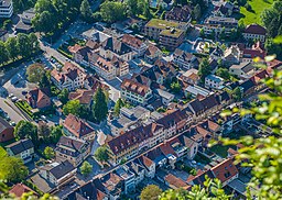
Hohenems är en stadskommun i distriktet Dornbirn i förbundslandet Vorarlberg i Österrike. I nordväst gränsar kommunen mot Schweiz. Kommunen har 17 239 invånare (2023).
Referenser
- ^ ”Gemeindeverzeichnis” (på tyska) (.ods). Statistik Austria. https://www.statistik.at/fileadmin/pages/453/RegGemVZ.ods. Läst 25 augusti 2023.
- ^ ”Bevölkerung zu Jahresbeginn nach administrativen Gebietseinheiten (Bundesländer, NUTS-Regionen, Bezirke, Gemeinden) seit 2002” (på tyska) (.ods). Statistik Austria. https://www.statistik.at/fileadmin/pages/405/Bev_zu_Jahresbeginn_Gebietseinheiten_Zeitreihe.ods. Läst 25 augusti 2023.
Externa länkar
 Wikimedia Commons har media som rör Hohenems.
Media som används på denna webbplats
(c) Karte: NordNordWest, Lizenz: Creative Commons by-sa-3.0 de
Location map of Austria
Shiny red button/marker widget. Used to mark the location of something such as a tourist attraction.
Författare/Upphovsman: Ruebsal, Licens: CC BY-SA 3.0
Coat of arms of Hohenems, Vorarlberg, Austria
Författare/Upphovsman: Feel free to use my photos, but please mention me as the author and if you want send me a message. or (rufre@lenz-nenning.at), Licens: CC BY-SA 3.0 at
Hohenems, Marktstraße und Jüdisches Viertel.
Författare/Upphovsman: Joschi Täubler, Licens: CC BY-SA 3.0
District Dornbirn


