Hida
| Hida (飛騨市) | |
| Stad | |
| Land | |
|---|---|
| Region | Chūbu (Tōkai) |
| Prefektur | Gifu |
| Ö | Honshū |
| Koordinater | 36°14′N 137°11′Ö / 36.233°N 137.183°Ö |
| Area | 792,53 km²[1] |
| Folkmängd | 24 696 (1 okt 2015)[1] |
| Befolkningstäthet | 31 invånare/km² |
| Geonames | 11611937 |
 Hidas läge i Japan | |
 Hidas läge i Gifu prefektur | |
| Webbplats: http://www.city.hida.gifu.jp/ | |
Hida(japanska: 飛騨市?, Hida-shi) är en stad i Gifu prefektur i Japan. Staden bildades 2004 [1] genom en sammanslagning av kommunerna Furukawa, Kamioka, Kawai och Miyagawa.
Galleri
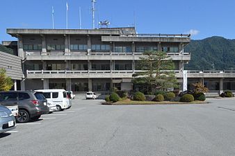
Stadshuset

Sugisaki station

Shinshuji-templet i Furukawa
Källor
- ^ [a b c] ”市区町村プロフィール (Kommunprofiler)” (på japanska). Masahiro Higashide. http://uub.jp/cpf/gifu.html. Läst 27 november 2016.
|
Media som används på denna webbplats


Red pog.svg
Shiny red button/marker widget. Used to mark the location of something such as a tourist attraction.
Shiny red button/marker widget. Used to mark the location of something such as a tourist attraction.

Hida City Hall ac.jpg
Författare/Upphovsman: Asturio Cantabrio, Licens: CC BY-SA 4.0
岐阜県飛騨市にある飛騨市役所本庁舎。
Författare/Upphovsman: Asturio Cantabrio, Licens: CC BY-SA 4.0
岐阜県飛騨市にある飛騨市役所本庁舎。
Japan location map with side map of the Ryukyu Islands.svg
Författare/Upphovsman: Maximilian Dörrbecker (Chumwa), Licens: CC BY-SA 3.0
Location map of Japan
Författare/Upphovsman: Maximilian Dörrbecker (Chumwa), Licens: CC BY-SA 3.0
Location map of Japan
Equirectangular projection.
Geographic limits to locate objects in the main map with the main islands:
- N: 45°51'37" N (45.86°N)
- S: 30°01'13" N (30.02°N)
- W: 128°14'24" E (128.24°E)
- E: 149°16'13" E (149.27°E)
Geographic limits to locate objects in the side map with the Ryukyu Islands:
- N: 39°32'25" N (39.54°N)
- S: 23°42'36" N (23.71°N)
- W: 110°25'49" E (110.43°E)
- E: 131°26'25" E (131.44°E)
Hida in Gifu Prefecture Ja.svg
Författare/Upphovsman: Lincun, Licens: CC BY-SA 3.0
Location of Hida in Gifu Prefecture
Författare/Upphovsman: Lincun, Licens: CC BY-SA 3.0
Location of Hida in Gifu Prefecture

Hida Furukawa Shinshuji Temple ac.jpg
Författare/Upphovsman: Asturio Cantabrio, Licens: CC BY-SA 4.0
岐阜県飛騨市の真宗寺。浄土真宗西本願寺派。
Författare/Upphovsman: Asturio Cantabrio, Licens: CC BY-SA 4.0
岐阜県飛騨市の真宗寺。浄土真宗西本願寺派。
