Hallig Hooge
| Hallig Hooge | ||
| Kommun | ||
(c) Michael Gäbler, CC BY 3.0 Backenswarft av de nordfrisiska hallig Hooge | ||
| ||
| Land | ||
|---|---|---|
| Förbundsland | Schleswig-Holstein | |
| Kreis | Nordfriesland | |
| Förvaltningsgemenskap | Amt Pellworm | |
| Höjdläge | 5 m ö.h. | |
| Koordinater | 54°34′10″N 8°32′45″Ö / 54.569444°N 8.545833°Ö | |
| Yta | 5,78 km² ()[1] | |
| Folkmängd | 104 ()[2] | |
| Befolkningstäthet | 18 inv./km² | |
| Borgmästare | Katja Just | |
| Postnummer | 25859 | |
| Riktnummer | (+49) 04849 | |
| Registreringsskylt | NF | |
| Kommunkod | 01 0 54 050 | |
| Geonames | 6551556 | |
| OSM-karta | 1420554 | |
Läget för Hallig Hooge i Tyskland | ||
Läget för kommunen Hallig Hooge i Kreis Nordfriesland | ||
| Webbplats: Hallig Hooge | ||
Hallig Hooge (danska: Hoge, frisiska: Huuge) är en kommun i Kreis Nordfriesland i förbundslandet Schleswig-Holstein i Tyskland. Kommunen ingår i kommunalförbundet Amt Pellworm tillsammans med ytterligare 3 kommuner.[3] och ligger på ön Hooge den näst största av de nordfrisiska halligar öarna i Vadehavet i Nordsjön utanför Schleswig-Holsteins kust. De tio tyska halligarna ligger i Nationalpark Schleswig-Holsteinisches Wattenmeer.[4]
Hooge är endast 5,5 km2 och bebos av cirka 100 invånare. Livet på ön är präglat av ebb och flod och de stormar som ibland sköljer över ön. Husen har byggts på 10 artificiella kullar (Terpen) för att undvika att bli översköljda vid starka stormar eller stark flod.
- Kyrkan på Hooge
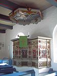
- Predikstol
Den tyske målaren Jakob Alberts tillbringade många somrar på öarna.
Noter
- ^ Alle politisch selbständigen Gemeinden mit ausgewählten Merkmalen am 31.12.2018 (4. Quartal) (på tyska), Statistisches Bundesamt, läs online, läst: 10 mars 2019.[källa från Wikidata]
- ^ Alle politisch selbständigen Gemeinden mit ausgewählten Merkmalen am 31.12.2023, Statistisches Bundesamt, 28 oktober 2024, läs online, läst: 16 november 2024.[källa från Wikidata]
- ^ ”Alle politisch selbständigen Gemeinden mit ausgewählten Merkmalen am 31.03.2020” (Excel). Statistisches Bundesamt. 2020. https://www.destatis.de/DE/Themen/Laender-Regionen/Regionales/Gemeindeverzeichnis/Administrativ/Archiv/GVAuszugQ/AuszugGV1QAktuell.xlsx?__blob=publicationFile. Läst 22 juli 2020.
- ^ ”Arkiverade kopian”. Arkiverad från originalet den 24 juni 2015. https://web.archive.org/web/20150624030717/http://www.wattenmeer-nationalpark.de/sh. Läst 6 december 2010.
Se även
|
Media som används på denna webbplats
Författare/Upphovsman: TUBS
Location map of Germany with waterbodies
Shiny red button/marker widget. Used to mark the location of something such as a tourist attraction.
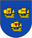
Coat of arms of the municipality Hooge in Schleswig-Holstein, Germany.
Författare/Upphovsman: Ingen maskinläsbar skapare angavs. Mghamburg antaget (baserat på upphovsrättsanspråk)., Licens: CC BY-SA 3.0
Shows the Church on the small German island Hooge in the North Sea.
Shot by MghamburgFörfattare/Upphovsman: Ingen maskinläsbar skapare angavs. Mghamburg antaget (baserat på upphovsrättsanspråk)., Licens: CC BY-SA 2.5
Shows the pulpit of the church on Hooge, a small german island in the North Sea.
Shot by Mghamburg(c) Michael Gäbler, CC BY 3.0
View to the Backenswarft on Hallig Hooge. The Hallig Hooge is the second largest of the ten islets in the Schleswig-Holstein Wadden Sea. Hallig Hooge is surrounded by an approximately 1.20 meters high stone dyke and is thus protected from light storm surges. Nevertheless Hallig Hooge is flooded completely two to five times a year. The Houses are built on high mounds. Therefore they can withstand the storm surges. The Hallig Hooge has twelve mounds. The Backenswarft is the second largest mound with a dozen buildings. The buildings surround the pond with rainwater.


