Gruyères
- För andra betydelser, se Gruyères (olika betydelser).
| Gruyères | ||
| franska: Commune de Gruyères | ||
| Kommun | ||
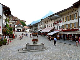
Huvudgatan i Gruyères | ||
| ||
| Land | ||
|---|---|---|
| Kanton | Fribourg | |
| Distrikt | Gruyère | |
| Höjdläge | 810 m ö.h. | |
| Koordinater | 46°35′1″N 7°4′54″Ö / 46.58361°N 7.08167°Ö | |
| Yta | 28,44 km²[1] | |
| Folkmängd | 2 241 (2021-12-31)[2] | |
| Befolkningstäthet | 79 inv./km² | |
| Tidszon | CET (UTC+1) | |
| - sommartid | CEST (UTC+2) | |
| Postnummer | 1663 | |
| Kommunkod | 2135 | |
| Geonames | 2660463 | |
| Språk | Franska | |
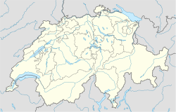
Gruyères läge i Schweiz | ||
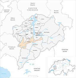
Detaljkarta | ||
| Webbplats: www.gruyeres.ch | ||
Gruyères (franskt uttal: [ɡʁɥijɛʁ] (![]() lyssna), tyska: Greyerz[3]) är en småstad och kommun i distriktet Gruyère i kantonen Fribourg i Schweiz. Kommunen hade 2 241 invånare (2021).[2] I kommunen finns även byarna Epagny, Pringy och Moléson-sur-Gruyères.
lyssna), tyska: Greyerz[3]) är en småstad och kommun i distriktet Gruyère i kantonen Fribourg i Schweiz. Kommunen hade 2 241 invånare (2021).[2] I kommunen finns även byarna Epagny, Pringy och Moléson-sur-Gruyères.
Gruyères har gett sitt namn till hårdosten Gruyère.
Referenser
- ^ ”Arealstatistik Standard - Gemeinden nach 4 Hauptbereichen” (på tyska/franska). Bundesamt für Statistik. 25 november 2021. https://dam-api.bfs.admin.ch/hub/api/dam/assets/19805706/master.
- ^ [a b] ”Bilanz der ständigen Wohnbevölkerung nach Bezirken und Gemeinden, 1991-2021” (på tyska/franska/italienska). Bundesamt für Statistik. 25 augusti 2022. https://dam-api.bfs.admin.ch/hub/api/dam/assets/23064893/master.
- ^ ”Gemeindenamen mit gebräuchlichen Übersetzungen” (på tyska). www.bfs.admin.ch. Bundesamt für Statistik. https://www.bfs.admin.ch/bfs/de/home/grundlagen/agvch/gemeindenamen-gebraeuchlichen-uebersetzungen.html. Läst 26 juli 2023.
Externa länkar
 Wikimedia Commons har media som rör Gruyères.
- Officiell webbplats
| |||||||||
Media som används på denna webbplats
Författare/Upphovsman: NordNordWest, Licens: CC BY-SA 3.0
Location map of Switzerland
Shiny red button/marker widget. Used to mark the location of something such as a tourist attraction.
Författare/Upphovsman: Dietrich Michael Weidmann, Licens: CC BY-SA 3.0
Corbières and Lake of Gruère seen from the rest area La Gruyère, canton of Fribourg, Switzerland
Författare/Upphovsman:
- Talare: Benoît Prieur
- Inspelare: Benoît Prieur
Uttalsljudfil
Författare/Upphovsman: Tschubby, Licens: CC BY-SA 3.0
Municipality Gruyères
Coat of arms of the municipality of Gruyères in the canton of Fribourg, Switzerland
The main street of the medieval city of Gruyères as it leads up to the Château.


