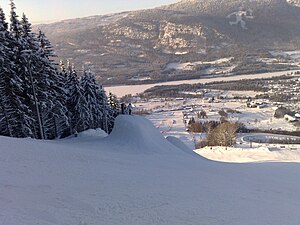
Granrudmoen
| Granrudmoen | |
| Ort | |
(c) Henrik søvang, CC BY 3.0 | |
| Land | |
|---|---|
| Fylke | Innlandet fylke |
| Kommun | Øyers kommun |
| Koordinater | 61°14′43″N 10°26′26″Ö / 61.24528°N 10.44056°Ö |
| Folkmängd | 1 630 (2019)[1] |
| Tidszon | CET (UTC+1) |
| - sommartid | CEST (UTC+2) |
| Tätortskod | 1611 |
(c) Karte: NordNordWest, Lizenz: Creative Commons by-sa-3.0 de Ortens läge i Innlandet fylke | |
(c) Karte: NordNordWest, Lizenz: Creative Commons by-sa-3.0 de Innlandet fylke i Norge | |
| Wikimedia Commons: Granrudmoen | |
Redigera Wikidata | |
Granrudmoen är en tätort i Innlandet fylke i Norge. Orten ligger i Gudbrandsdalen, vid Europaväg 6, Dovrebanan och älven Gudbrandsdalslågen.[2] Den utgör kommunens största tätort.
I nära anslutning till orten ligger skidanläggningen Hafjell.
Bilder
- (c) Guntars Mednis, CC BY-SA 3.0
Referenser
- ^ Tettsteders befolkning og areal (på norskt bokmål), Statistisk sentralbyrå, läs online.[källa från Wikidata]
- ^ Norgeskart.no
Media som används på denna webbplats
Författare/Upphovsman: Gutten på Hemsen, Licens: CC0
Flag of Norway with colors from the previous version on Commons. This file is used to discuss the colors of the Norwegian flag.
Shiny red button/marker widget. Used to mark the location of something such as a tourist attraction.
Författare/Upphovsman: Ole C Eid, Licens: CC BY-SA 2.0
Hafjell is a village and a ski resort in Norway, in the Øyer municipality in the county of Oppland.
Hafjell hosted the alpine skiing technical events (giant slalom and slalom) at the 1994 Winter Olympics.(c) Karte: NordNordWest, Lizenz: Creative Commons by-sa-3.0 de
Location of county Innlandet in Norway (2024)
(c) Karte: NordNordWest, Lizenz: Creative Commons by-sa-3.0 de
Location map of Innlandet, Norway


