Gorontalo
- För andra betydelser, se Gorontalo (olika betydelser).
| Gorontalo | |||
| Stad | |||
Centrala Gorontalo, 2018. | |||
| |||
| Officiellt namn: Kota Gorontalo | |||
| Land | |||
|---|---|---|---|
| Provins | Gorontalo | ||
| Koordinater | 00°32′13″N 123°03′38″Ö / 0.53694°N 123.06056°Ö | ||
| Area | 67,27 km²[1] | ||
| Folkmängd | 219 399 (2019)[1] | ||
| Befolkningstäthet | 3 261 invånare/km² | ||
| Geonames | 1643837 | ||
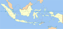
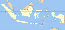
Gorontalos läge på karta över Indonesien. | |||
Gorontalo är en stad på norra Sulawesi i Indonesien. Den är administrativ huvudort för provinsen Gorontalo och har cirka 220 000 invånare.
Administrativ indelning
Gorontalo är indelad i sex underdistrikt (kecamatan):[2]
- Dungingi
- Kota Barat
- Kota Selatan
- Kota Tengah
- Kota Timur
- Kota Utara
Källor
- ^ [a b] Badan Pusat Statistik, Indonesien; Indonesia population projection at province (adm1) and district (adm2) level, 2010 – 2020 (excelfil) Läst 26 april 2020.
- ^ Badan Pusat Statistik, Indonesia; Hasil Sensus Penduduk 2010, Publikasi Provinsi dan Kabupaten Hasil Sementara SP2010 Arkiverad 13 oktober 2010 hämtat från the Wayback Machine. Läst 6 oktober 2010.
Media som används på denna webbplats
Shiny red button/marker widget. Used to mark the location of something such as a tourist attraction.
Coat of arms of Gorontalo City, Gorontalo
bendera Indonesia
Författare/Upphovsman: Gorontalo City, Licens: CC BY-SA 4.0
Flag of Gorontalo City, based on this image
Grand Mosque of Baiturrahim in the city of Gorontalo, Sulawesi, Indonesia
Författare/Upphovsman: en:User:Indon, Licens: CC BY-SA 3.0
Indonesia provinces blank map


