Givatayim
| Giv‘atayim (גבעתיים) | |
| Gevataym | |
| Ort | |
En park i Givatayim. | |
| Land | |
|---|---|
| Distrikt | Tel Aviv |
| Koordinater | 32°4′11″N 34°48′42″Ö / 32.06972°N 34.81167°Ö |
| Folkmängd | 57 508 (2015-12-31)[1] |
| Tidszon | EET (UTC+2) |
| - sommartid | EEST (UTC+3) |
| Geonames | 294999 |
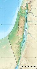
Läge i Israel | |
Givatayim (hebreiska: גבעתיים) är en stad i storstadsområdet Gush Dan i Israel. Den har 57 508 invånare[1] och grundades 1922. Stadens namn betyder "två kullar", och kommer av de två kullar som ligger i närheten av där staden byggdes.
Källor
- ^ [a b] List of localities, in Alphabetical order Arkiverad 16 augusti 2016 hämtat från the Wayback Machine., Israel Central Bureau of Statistics. Läst 21 augusti 2017.
Media som används på denna webbplats
Flag of Israel. Shows a Magen David (“Shield of David”) between two stripes. The Shield of David is a traditional Jewish symbol. The stripes symbolize a Jewish prayer shawl (tallit).
Shiny red button/marker widget. Used to mark the location of something such as a tourist attraction.
Författare/Upphovsman: Eric Gaba (Sting - fr:Sting) and NordNordWest, Licens: CC BY-SA 3.0
Location map of Israel. De facto situation.
Författare/Upphovsman: Deanb at en.wikipedia, Licens: CC BY-SA 3.0
Public Garden in Giv'atayim, Israel


