Gallatin County, Montana
| Gallatin County | |
| County | |
Gallatin County Courthouse. | |
| Land | |
|---|---|
| Delstat | |
| Huvudort | Bozeman |
| Största stad | Bozeman |
| Area | 6 817 km² (2010)[1] |
| - land | 6 741 km² (99%) |
| - vatten | 76,1 km² (1%) |
| Folkmängd | 89 513 (2010)[2] |
| Befolkningstäthet | 13 invånare/km² |
| Grundat | 1864 |
| Tidszon | MST (UTC-7) |
| - sommartid | MDT (UTC-6) |
| FIPS-kod | 30031 |
| Geonames | 5653656 |
Läge i delstaten Montana. | |
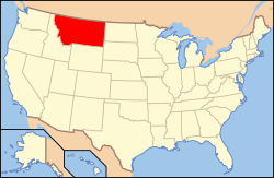
Delstatens läge i USA. | |
Gallatin County är ett administrativt område i delstaten Montana, USA, med 89 513 invånare. Den administrativa huvudorten (county seat) är Bozeman.
Del av Yellowstone nationalpark ligger i countyt.
Geografi
Enligt United States Census Bureau så har countyt en total area på 6 817 km². 6 750 km² av den arean är land och 67 km² är vatten.
Angränsande countyn
- Madison County - väst
- Jefferson County - nordväst
- Broadwater County - nord
- Meagher County - nordost
- Park County - öst
- Park County, Wyoming - sydost
- Teton County, Wyoming - sydost
- Fremont County, Idaho - sydväst
Orter
- Amsterdam
- Bozeman (huvudort)
Källor
- ^ ”2010 Census U.S. Gazetteer Files for Counties”. U.S. Census Bureau. Arkiverad från originalet den 5 juli 2012. https://www.webcitation.org/68vYLbou5?url=http://www.census.gov/geo/www/gazetteer/files/Gaz_counties_national.txt. Läst 5 juli 2012.
- ^ ”State & County QuickFacts, Gallatin County, Montana” (på engelska). U.S. Census Bureau. Arkiverad från originalet den 10 juli 2011. https://www.webcitation.org/604SmZ0rB?url=http://quickfacts.census.gov/qfd/states/30/30031.html. Läst 6 juli 2011.
| ||||||||||
Media som används på denna webbplats
Författare/Upphovsman: This version: uploader
Base versions this one is derived from: originally created by en:User:Wapcaplet, Licens: CC BY 2.0
Map of U.S. with Montana highlighted
Författare/Upphovsman: This version: uploader
Base versions this one is derived from: originally created by en:User:Wapcaplet, Licens: CC BY 2.0
Map of U.S. with Montana highlighted
This is a locator map showing Gallatin County in Montana. For more information, see Commons:United States county locator maps.
Författare/Upphovsman: Tim Evanson, Licens: CC BY-SA 2.0
Looking east-northeast at the Gallatin County Courthouse, 301 W. Main Street, Bozeman, Montana. Designed by local architect Fred Willson (who built much of downtown Bozeman), it was constructed from 1935 to 1936. The Art Deco structure was built partially with federal funds from the Public Works Administration. The structure was listed on the National Register of Historic Places on December 21, 1987.


