Franklin, Texas
| Franklin | |
| city | |
Stadshuset | |
| Land | |
|---|---|
| Delstat | Texas |
| County | Robertson County |
| Höjdläge | 137 m ö.h. |
| Koordinater | 31°1′34″N 96°29′7″V / 31.02611°N 96.48528°V |
| Yta | 2,4 km² (2010) |
| - land | 2,4 km² |
| - vatten | 0,0 km² |
| Folkmängd | 1 741 (2010) |
| Befolkningstäthet | 725 invånare/km² |
| Tidszon | CST (UTC-6) |
| - sommartid | CDT (UTC-5) |
| ZIP-kod | 77856 |
| FIPS | 4827288 |
| Geonames | 4692193 |
Ortens läge i Texas | |
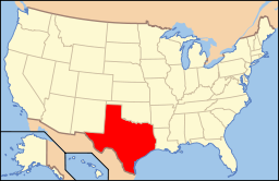
Texas läge i USA | |
| Webbplats: http://cityoffranklintx.com/ | |
Franklin är administrativ huvudort i Robertson County i Texas.[1][2] Orten grundades 1872 och fick först heta Morgan efter en järnvägstjänsteman. Postkontoret öppnades 1880 och orsaken till namnbytet låg i ansökningen om att grunda ett postkontor. Namnet ändrades till Franklin för att undvika förväxling med en annan ort som hade ett postkontor med samma namn.[3] Enligt 2010 års folkräkning hade Franklin 1 564 invånare.[4]
Källor
- ^ Texas County Map with County Seat Cities. Geology.com Geoscience News and Information. Läst 18 augusti 2016.
- ^ Profile for Franklin, Texas Arkiverad 14 september 2016 hämtat från the Wayback Machine.. ePodunk. Läst 18 augusti 2016.
- ^ Franklin, TX (Robertson County). Handbook of Texas Online. Läst 18 augusti 2016.
- ^ 2010 Census Population of Franklin, Texas Arkiverad 27 augusti 2016 hämtat från the Wayback Machine.. Census Viewer. Läst 18 augusti 2016.
Media som används på denna webbplats
Författare/Upphovsman: This version: uploader
Base versions this one is derived from: originally created by en:User:Wapcaplet, Licens: CC BY 2.0
Map of USA with Texas highlighted
Författare/Upphovsman: The original uploader was Seth Ilys på engelska Wikipedia., Licens: CC BY-SA 3.0
Adapted from Wikipedia's TX county maps by Seth Ilys.
Författare/Upphovsman: Billy Hathorn, Licens: CC BY-SA 3.0
I took photo with Canon camera in Franklin, TX: the City Hall


