Fläsch
| Fläsch | ||
| tyska: Gemeinde Fläsch | ||
| Kommun | ||
Fläsch | ||
| ||
| Land | ||
|---|---|---|
| Kanton | ||
| Region | Landquart | |
| Höjdläge | 525 m ö.h. | |
| Koordinater | 47°01′35″N 9°30′49″Ö / 47.02639°N 9.51361°Ö | |
| Högsta punkt | ||
| - läge | Vorder-Grauspitz | |
| - höjdläge | 2 599 m ö.h. | |
| Lägsta punkt | ||
| - läge | Ellhorn | |
| - höjdläge | 483 m ö.h. | |
| Yta | 19,94 km²[1] | |
| Folkmängd | 832 (2021-12-31)[2] | |
| Befolkningstäthet | 42 inv./km² | |
| Tidszon | CET (UTC+1) | |
| - sommartid | CEST (UTC+2) | |
| Postnummer | 7306 | |
| Kommunkod | 3951 | |
| Geonames | 2660763 | |
| Språk | Tyska | |
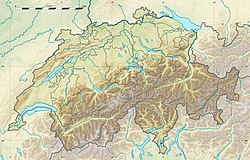
Fläschs läge i Schweiz | ||
Detaljkarta kommunindelning | ||
| Webbplats: http://www.flaesch.ch/ | ||
Fläsch är en ort och kommun i regionen Landquart i kantonen Graubünden, Schweiz. Kommunen har 832 invånare (2021).[2] Kommunen ligger i landskapet Bündner Herrschaft.
Kommunen har kantonens nordligaste bebyggelse, och gränsar i väster (i floden Rhen) mot kanton Sankt Gallen samt i norr mot furstendömet Liechtenstein. Kommunens högsta punkt är Vorder-Grauspitz, 2 599 m ö.h., tillika Liechtensteins högsta punkt.
Språk
Det rätoromanska språket trängdes undan av tyska under 1300-talen genom inflyttning från lägre belägna delar av Rhendalen och området runt Bodensjön.
Religion
Fläsch reformerades 1524.
Källor
- Fläsch på tyska, franska och italienska i webbaserade Schweiz historielexikon.
Noter
- ^ ”Arealstatistik Standard - Gemeinden nach 4 Hauptbereichen” (på tyska/franska). Bundesamt für Statistik. 25 november 2021. https://dam-api.bfs.admin.ch/hub/api/dam/assets/19805706/master.
- ^ [a b] ”Bilanz der ständigen Wohnbevölkerung nach Bezirken und Gemeinden, 1991-2021” (på tyska/franska/italienska). Bundesamt für Statistik. 25 augusti 2022. https://dam-api.bfs.admin.ch/hub/api/dam/assets/23064893/master.
| |||||||||
Media som används på denna webbplats
Författare/Upphovsman: Eric Gaba (Sting - fr:Sting) and NordNordWest, Licens: CC BY-SA 3.0
Blank physical map of Switzerland, for geo-location purpose. More maps: → Maps of Switzerland.
Shiny red button/marker widget. Used to mark the location of something such as a tourist attraction.
Författare/Upphovsman: Adrian Michael, Licens: CC BY-SA 3.0
reformierte Kirche von de:Fläsch
Författare/Upphovsman: Tschubby, Licens: CC BY-SA 3.0
Municipality Malans
Coat of Arms of Switzerland.
The "triangular" shield shape was frequently used by the federal administration throughout the 20th century, and adopted officially (as emblem of the federal administration, not necessarily as emblem of Switzerland as sovereign entity) in 2017. Precedents for this shield shape go back to designs dated to as early as 1815.
The official coat of arms of the Swiss Confederation is a white couped cross in a red heraldic shield, without explicit specification of the shape of the shield, and a variety of shield shapes are in use.


