Fjalers kommun
| Fjalers kommun | |||
| Fjaler kommune | |||
| Kommun | |||
Dalsfjorden | |||
| |||
| Land | |||
|---|---|---|---|
| Fylke | Vestland fylke | ||
| Koordinater | 61°18′22″N 5°27′48″Ö / 61.30611°N 5.46333°Ö | ||
| Centralort | Dale | ||
| Area | 488,16 km² (2020)[3] | ||
| - land | 390,07 km² (2020) | ||
| - vatten | 98,06 km² | ||
| Folkmängd | 2 913 (2023)[4] | ||
| Befolkningstäthet | 7 invånare/km² | ||
| Politik | |||
| - Kommunstyrelsens ordförande | Kjetil Høgseth Felde (2019–) (Sp)[2] | ||
| Tidszon | CET (UTC+1) | ||
| - sommartid | CEST (UTC+2) | ||
| Kommunkod | 4646 (2020–) 1429 (–2019) | ||
| Geonames | 3157409 | ||
| Målform | nynorska | ||
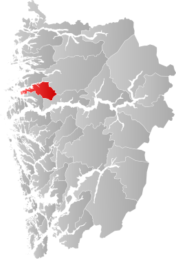
 Fjalers kommun i Vestland fylke. | |||
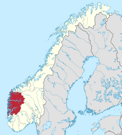
(c) Karte: NordNordWest, Lizenz: Creative Commons by-sa-3.0 de Vestland fylke i Norge. | |||
| Wikimedia Commons: Fjaler | |||
| Webbplats: https://www.fjaler.kommune.no/ | |||
| Redigera Wikidata | |||
Fjalers kommun (norska: Fjaler kommune) är en kommun i landskapet Sunnfjord i Vestland fylke i västra Norge. Tätorten Dale utgör kommunens centralort.
Kommunen tillhörde tidigare dåvarande Sogn og Fjordane fylke.
Administrativ historik
Ytre Holmedals kommun upprättades den 1 januari 1838 (som Yttre Holmedal formannskapsdistrikt) när Formannskapslovene från 1837 trädde i kraft. Kommunen omfattade de mellersta och östra delarna av nuvarande Fjalers kommun samt ett område i den sydöstra delen av nuvarande Askvolls kommun och ett område i den västra delen av nuvarande Sunnfjords kommun.
1912 bytte kommunen namn från Ytre Holmedals kommun till Fjalers kommun.[5]
Den 1 januari 1990 överfördes ett bebott område söder om Dalsfjorden (grundkretsarna 0301 Fure, 0302 Folkestad och 0303 Våge med totalt 482 invånare) från Askvolls kommun till Fjalers kommun.[6]
Samtidigt överfördes ett bebott område norr om Dalsfjorden (grundkretsarna 0101 Vårdal, 0102 Holmedal och 0103 Rivedal samt gårdsnummer 46 i grunnkrets 0209 Hestad med med totalt 731 invånare) från Fjalers kommun till Askvolls kommun medan att annat bebott område norr om samma fjord (den återstående delen av grundkrets 0209 Hestad med 90 invånare) överfördes från Fjalers kommun till Gaulars kommun.[6]
Fjalers kommun omfattar sedan gränsregleringarna 1990 enbart områden söder om Dalsfjorden medan Askvolls kommun enbart omfattar områden norr om den.[7]
Tätorter
I Fjalers kommun finns två tätorter:[8]
Socknar
Inom Norska kyrkan motsvaras Fjalers kommun av Fjalers socken i Sunnfjords prosteri i Bjørgvins stift.[5]
Källor
- ^ [a b] Dag Juvkam, Historisk oversikt over endringer i kommune- og fylkesinndelingen, Statistisk sentralbyrå, maj 1999, s. 56, ISBN 82-537-4684-9, läs online.[källa från Wikidata]
- ^ läs online, www.fjaler.kommune.no , läst: 9 mars 2021.[källa från Wikidata]
- ^ Statens kartverk, Arealstatistikk for Norge 2020, Statens kartverk, 20 december 2019, läs online.[källa från Wikidata]
- ^ 07459: Alders- og kjønnsfordeling i kommuner, fylker og hele landets befolkning (K) 1986 - 2023 (på norskt bokmål), Statistisk sentralbyrå, 21 februari 2023, läs online.[källa från Wikidata]
- ^ [a b] Store norske leksikon
- ^ [a b] ”Historisk oversikt over endringer i kommune- og fylkesinndelingen” (PDF). Statistisk sentralbyrå. Maj 1999. https://www.ssb.no/a/publikasjoner/pdf/rapp_9913/rapp_9913.pdf.
- ^ Norgeskart.no
- ^ ”Tettsteders befolkning og areal”. Statistisk sentralbyrå. 14 december 2022. https://www.ssb.no/befolkning/folketall/statistikk/tettsteders-befolkning-og-areal.
Externa länkar
- Officiell webbplats
 Wikimedia Commons har media som rör Fjalers kommun.
| |||||||
| ||||||||||
Media som används på denna webbplats
Författare/Upphovsman: Gutten på Hemsen, Licens: CC0
Flag of Norway with colors from the previous version on Commons. This file is used to discuss the colors of the Norwegian flag.
(c) Karte: NordNordWest, Lizenz: Creative Commons by-sa-3.0 de
Location of county Vestland in Norway (2024)
Författare/Upphovsman: Jay1279, Licens: CC0
Map of Fjaler municipality in Vestland county, Norway
Flag of Fjaler municipality
Coat of arms for Vestland county, Norway
Författare/Upphovsman: Jarkko Laine, Licens: CC BY 2.0
The image is cropped by me, User:Jorunn
Neset ca. midt i biletet, på andre sida av fjorden, er Straumsnes. Innom Straumsnes heiter fjorden Dalsfjorden, utom heiter han Vilnesfjorden. Landet på andre sidan av fjorden er i Fjaler kommune, medan det på den sida der fotografen er er Askvoll. Gardane nedom fjellet/åsen fotografen er på er i Rivedal. Vegen ein ser gå ned mot fjorden til venstre i biletet er Riksveg 609. Vegen ein kan sjå konturane av på andre sida av fjorden er Fylkesveg 394 i Sogn og Fjordane. Vatnet til høgre i biletet er Bakkevatnet.
In English (Translation by MyLegAlta) : The point near the centre of the picture, on the other side of the fjord, is Straumsnes. Beyond Straumsnes, the fjord is called Vilnesfjorden, and inland from that point, it is named Dalsfjord. The municipality of Fjaler is on the other side of the fjord, while the photo was taken from the municipality of Askvoll.The farms seen blow the mountain form the which the photo was taken are located in Rivedal. The road on the left side of the picture going down towards the fjord is Riksveg 609. The contour of Fylkesveg 394 can be seen on the other side of the fjord. The body of water on the right of the picture is called Bakkevatnet.Coat of arms for Sogn og Fjordane county (fylke), Norway.The coat of arms were granted on 23 September 1983. The arms show the geographical layout of the county: three large fjords protruding into the land. The three fjords are the Nordfjord, Sunnfjord and Sognefjord. As nearly all villages and towns are situated on one of these fjords and the name of the county is based on the fjords.
Coat of arms for the Norwegian municipality of Fjaler.


