Falmouth, Massachusetts
| Den här artikeln behöver källhänvisningar för att kunna verifieras. (2021-10) Åtgärda genom att lägga till pålitliga källor (gärna som fotnoter). Uppgifter utan källhänvisning kan ifrågasättas och tas bort utan att det behöver diskuteras på diskussionssidan. |
| Falmouth | |
| Kommun (town) | |
| Uppkallad efter: Falmouth | |
| Land | |
|---|---|
| Delstat | |
| County | Barnstable County |
| Höjdläge | 3 m ö.h. |
| Koordinater | 41°33′5″N 70°36′55″V / 41.55139°N 70.61528°V |
| Area | 141 km² |
| Folkmängd | 32 517 (2020)[2] |
| Befolkningstäthet | 231 invånare/km² |
| Grundad | 1660[1] |
| Tidszon | EST (UTC-5) |
| - sommartid | EDT (UTC-4) |
| ZIP-kod | 02540 |
| GNIS-kod | 618253 |
| Geonames | 4936174 |
Översiktskarta | |
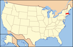
Massachusetts läge i USA | |
| Wikimedia Commons: Falmouth, Massachusetts | |
| Webbplats: http://www.falmouthmass.us/ | |
| Redigera Wikidata | |
Falmouth är en kommun (town) i Barnstable County i Massachusetts i USA med cirka 32 517 invånare (2020). Den har enligt United States Census Bureau en area på 141 km².
| ||||||||||
- ^ hämtat från: franskspråkiga Wikipedia.[källa från Wikidata]
- ^ United States Census Bureau (red.), USA:s folkräkning 2020, läs online, läst: 1 januari 2022.[källa från Wikidata]
Media som används på denna webbplats
Författare/Upphovsman: Tkgd2007, Licens: CC BY-SA 3.0
A new incarnation of Image:Question_book-3.svg, which was uploaded by user AzaToth. This file is available on the English version of Wikipedia under the filename en:Image:Question book-new.svg
(c) ToddC4176 at the English Wikipedia, CC BY-SA 3.0
The Nobska Lighthouse, Falmouth, Massachusetts, as viewed from the shore.
Författare/Upphovsman: This version: uploader
Base versions this one is derived from: originally created by en:User:Wapcaplet, Licens: CC BY 2.0
Map of USA with Massachusetts highlighted
Författare/Upphovsman: Rcsprinter123, Licens: CC BY 3.0
Map showing the location of this town within Barnstable County, Massachusetts. Data source: 2010 U.S. census


