Emberton
| Den här artikeln har skapats av Lsjbot, ett program (en robot) för automatisk redigering. (2016-05) Artikeln kan innehålla fakta- eller språkfel, eller ett märkligt urval av fakta, källor eller bilder. Mallen kan avlägsnas efter en kontroll av innehållet (vidare information) |
| Emberton | |
| Parish | |
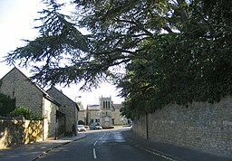
(c) John Winfield, CC BY-SA 2.0 Emberton | |
| Land | |
|---|---|
| Riksdel | England |
| Ceremoniellt grevskap | Buckinghamshire |
| Enhetskommun | Milton Keynes |
| Koordinater | 52°08′06″N 0°40′33″V / 52.1349°N 0.67593°V |
| Tidszon | UTC (UTC+0) |
| - sommartid | BST (UTC+1) |
| Geonames | 2650019 7299258 |
Läge i Storbritannien | |
Emberton är en ort och en civil parish i kommunen Milton Keynes i Storbritannien.[1] Den ligger i grevskapet Buckinghamshire och riksdelen England, i den södra delen av landet, 80 km nordväst om huvudstaden London.
Källor
- ^ Emberton hos Geonames.org (cc-by); post uppdaterad 2010-05-26; databasdump nerladdad 2016-05-06
| ||||||||||||||||||||||||||
Media som används på denna webbplats
Robot icon
Författare/Upphovsman: Alexrk2, Licens: CC BY-SA 3.0
Location map of the United Kingdom
Shiny red button/marker widget. Used to mark the location of something such as a tourist attraction.
(c) John Winfield, CC BY-SA 2.0
Emberton. Located just off the A509, near Olney, Emberton has a mixture of old limestone and red brick houses and cobble. In the centre of the photograph is the 19th-century stone clock tower which stands on the corner of the High Street and Olney Road.


