Elmdale, Kansas
| Elmdale | |
| city | |
| Land | |
|---|---|
| Delstat | Kansas |
| County | Chase County |
| Höjdläge | 365 m ö.h. |
| Koordinater | 38°22′25″N 96°38′41″V / 38.37361°N 96.64472°V |
| Yta | 0,4 km² (2010) |
| - land | 0,4 km² |
| - vatten | 0,0 km² |
| Folkmängd | 55 (2010) |
| Befolkningstäthet | 138 invånare/km² |
| Tidszon | CST (UTC-6) |
| - sommartid | CDT (UTC-5) |
| ZIP-kod | 66850 |
| Riktnummer | 620 |
| FIPS | 2020675 |
| Geonames | 4271003 |
Ortens läge i Kansas | |
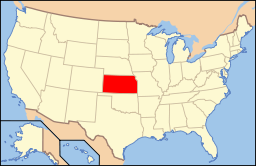
Kansas läge i USA | |
Elmdale är en ort i Chase County i Kansas.[1] Vid 2010 års folkräkning hade Elmdale 55 invånare.[2]
Källor
- ^ Elmdale, KS. Map Quest. Läst 30 december 2019.
- ^ 2010 Census Population of Elmdale, Kansas Arkiverad 30 december 2019 hämtat från the Wayback Machine.. Census Viewer. Läst 30 december 2019.
Media som används på denna webbplats
Författare/Upphovsman: Alexrk2, Licens: CC BY 3.0
Den här Det karta skapades med GeoTools.
Shiny red button/marker widget. Used to mark the location of something such as a tourist attraction.
Författare/Upphovsman: This version: uploader
Base versions this one is derived from: originally created by en:User:Wapcaplet, Licens: CC BY 2.0
Map of USA with Kansas highlighted
Författare/Upphovsman: craig Cloutier from Boston, United States, Licens: CC BY-SA 2.0
Elmdale is a 4 four block ghost town in the middle of Kansas. About 20 percent of the houses seem to be inhabited. The rest seem to be haunted.
In the next town over, Cottonwood Falls, we overheard someone say that they were looking for a new priest in Elmdale. We didn't stick around long enough to find out what happened to the old priest. We also didn't spend a lot of time taking photos, since the zombies were on our tail and we were headed for Diamond Springs.


