Elkins, West Virginia
| Elkins | |
| city | |
Taylor-Condry House | |
| Land | |
|---|---|
| Delstat | West Virginia |
| County | Randolph County |
| Höjdläge | 587 m ö.h. |
| Koordinater | 38°55′33″N 79°50′48″V / 38.92583°N 79.84667°V |
| Yta | 8,9 km² (2010) |
| - land | 8,9 km² |
| - vatten | 0,0 km² |
| Folkmängd | 7 094 (2010) |
| Befolkningstäthet | 797 invånare/km² |
| Tidszon | EST (UTC-5) |
| - sommartid | EDT (UTC-4) |
| ZIP-kod | 26241 |
| Riktnummer | 304/681 |
| FIPS | 5424580 |
| Geonames | 4805033 |
Ortens läge i West Virginia | |
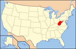
West Virginias läge i USA | |
| Webbplats: http://cityofelkinswv.com/ | |
Elkins är administrativ huvudort i Randolph County i West Virginia i USA.[1] Orten har fått sitt namn efter politikern Stephen Benton Elkins.[2][3] Enligt 2010 års folkräkning hade Elkins 7 094 invånare.[4]
Källor
- ^ West Virginia County Map with County Seat Cities. Geology.com Geoscience News and Information. Läst 20 februari 2017.
- ^ Profile for Elkins, West Virginia Arkiverad 21 februari 2017 hämtat från the Wayback Machine.. ePodunk. Läst 20 februari 2017.
- ^ Elkins, WV. Map Quest. Läst 20 februari 2017.
- ^ 2010 Census Population of Elkins, West Virginia Arkiverad 21 februari 2017 hämtat från the Wayback Machine.. Census Viewer. Läst 20 februari 2017.
|
Media som används på denna webbplats
Shiny red button/marker widget. Used to mark the location of something such as a tourist attraction.
Författare/Upphovsman: This version: uploader
Base versions this one is derived from: originally created by en:User:Wapcaplet, Licens: CC BY 2.0
Map of USA with West Virginia highlighted
Författare/Upphovsman: Alexrk2, Licens: CC BY 3.0
Location map of West Virginia, USA
Equirectangular projection, N/S stretching 130.0 %. Geographic limits of the map:
- N: 40.8° N
- S: 37.0° N
- W: 82.8° W
- E: 77.5° W
Författare/Upphovsman: JERRYE & ROY KLOTZ, M.D., Licens: CC BY-SA 4.0
AKA EDNALEA; BUILT 1880-1881 BASED ON A DESIGN SIMILAR TO MOUNT VERNON


