Elizabeth Reef
| Elizabeth Reef | |
| Atoll | |
Karta (1934) | |
| Land | |
|---|---|
| Koordinater | 29°56′30″S 159°03′45″Ö / 29.94167°S 159.0625°Ö |
| Geonames | 2167540 |
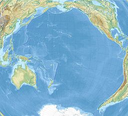
Elizabeth Reef är en atoll i Australien.[1] Den ligger i den östra delen av landet, 1 100 km nordost om huvudstaden Canberra. Administrativt tillhör den det externa territoriet Korallhavsöarna.
Källor
- ^ Elizabeth Reef hos GeoNames.Org (cc-by); post uppdaterad 2003-11-25; databasdump nerladdad 2015-12-01
Media som används på denna webbplats
Shiny red button/marker widget. Used to mark the location of something such as a tourist attraction.
Författare/Upphovsman:
Royal Zoological Society of New South Wales;
Royal Zoological Society of New South Wales. Proceedings, Licens: No restrictionsTitle: The Australian zoologist
Identifier: australianzoolog8193roya (find matches)
Year: 1914 (1910s)
Authors: Royal Zoological Society of New South Wales; Royal Zoological Society of New South Wales. Proceedings
Subjects: Zoology; Zoology; Zoology
Publisher: (Sydney, Royal Zoological Society of New South Wales)
Contributing Library: Smithsonian Libraries
Digitizing Sponsor: Biodiversity Heritage Library
View Book Page: Book Viewer
About This Book: Catalog Entry
View All Images: All Images From Book
Click here to view book online to see this illustration in context in a browseable online version of this book.
Text Appearing Before Image:
ELIZABETH REEF. 271 Hi^o/j 3nnj_ ^
Text Appearing After Image:
Ml O-
Note About Images
Författare/Upphovsman: Uwe Dedering, Licens: CC BY-SA 3.0
Relief location map of Pacific_Ocean.
- Projection: Lambert azimuthal equal-area projection.
- Area of interest:
- N: 60.0° N
- S: −80.0° N
- W: −260.0° E
- E: −70.0° E
- Projection center:
- NS: −10.0° N
- WE: −165.0° E
- GMT projection: -JA-165.0/-10.0/180/19.998266666666666c
- GMT region: -R-320.2519138145009/-12.459450078533589/-5.473602099069988/26.40516525873812r
- GMT region for grdcut: -R-325.0/-90.0/-5.0/74.0r
- Relief: SRTM30plus.
- Made with Natural Earth. Free vector and raster map data @ naturalearthdata.com.


