Edgerley
| Den här artikeln har skapats av Lsjbot, ett program (en robot) för automatisk redigering. (2016-05) Artikeln kan innehålla fakta- eller språkfel, eller ett märkligt urval av fakta, källor eller bilder. Mallen kan avlägsnas efter en kontroll av innehållet (vidare information) |
| Edgerley | |
| Parish | |
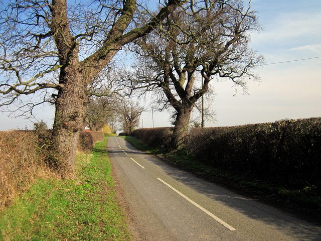
 (c) Jeff Buck, CC BY-SA 2.0 | |
| Land | |
|---|---|
| Riksdel | England |
| Enhetskommun | Cheshire West and Chester |
| Ceremoniellt grevskap | Cheshire |
| Civil parish | Churton |
| Koordinater | 53°06′25″N 2°50′45″V / 53.10689°N 2.84572°V |
| Folkmängd | 7 (2001) |
| Tidszon | UTC (UTC+0) |
| - sommartid | BST (UTC+1) |
| Geonames | 7298047 |
 Läge i Storbritannien | |
Edgerley var en civil parish 1866–2015[1] när det uppgick i Churton,[2] i distriktet Cheshire West and Chester, i Storbritannien.[3] Det ligger i grevskapet Cheshire och riksdelen England, i den södra delen av landet, 250 km nordväst om huvudstaden London. Civil parish hade 7 invånare år 2001.[4]
Källor
- ^ ”Relationships and changes Edgerley Tn/CP through time”. A Vision of Britain through Time. https://visionofbritain.org.uk/unit/10156117. Läst 30 augusti 2023.
- ^ ”Cheshire West and Chester Registration District”. UKBMD. https://www.ukbmd.org.uk/reg/districts/cheshire%20west%20and%20chester.html. Läst 30 augusti 2023.
- ^ Edgerley hos Geonames.org (cc-by); post uppdaterad 2010-10-17; databasdump nerladdad 2016-05-06
- ^ ”Edgerley”. GENUKI. Arkiverad från originalet den 30 augusti 2023. https://web.archive.org/web/20230830100929/https://www.genuki.org.uk/big/eng/CHS/Edgerley. Läst 30 augusti 2023.
Media som används på denna webbplats
Robot icon
.svg)
Författare/Upphovsman: Alexrk2, Licens: CC BY-SA 3.0
Location map of the United Kingdom

Shiny red button/marker widget. Used to mark the location of something such as a tourist attraction.
(c) Jeff Buck, CC BY-SA 2.0
Edgerley Lane near Churton, CTYPE html PUBLIC "-//W3C//DTD XHTML 1.0 Strict//EN"
"http://www.w3.org/TR/xhtml1/DTD/xhtml1-strict.dtd">
<html xmlns="http://www.w3.org/1999/xhtml" xml:lang="en" id="geograph"> <head>
<title>Edgerley Lane near Churton:: OS grid SJ4356 :: Geograph Britain and Ireland - photograph every grid square!</title> <meta http-equiv="Content-Type" content="text/html; charset=iso-8859-1" /> <meta name="description" content="Edgerley Lane is also part of the Bishop Bennet Way long distance footpath." /> <meta name="ICBM" content="53.105816376175, -2.8480869311411"/> <meta name="DC.title" content="Geograph:: Edgerley Lane near Churton:: OS grid SJ4356"/> <meta property="og:image" content="http://s0.geograph.org.uk/geophotos/02/82/90/2829005_def29a04.jpg"/> <link rel="stylesheet" type="text/css" title="Monitor" href="http://s1.geograph.org.uk/templates/basic/css/basic.v7747.css" media="screen" /> <link rel="shortcut icon" type="image/x-icon" href="http://s1.geograph.org.uk/favicon.ico"/> <link rel="alternate" type="application/vnd.google-earth.kml+xml" href="/photo/2829005.kml"/> <link rel="search" type="application/opensearchdescription+xml" title="Geograph Britain and Ireland search" href="/stuff/osd.xml" /> <script type="text/javascript" src="http://s1.geograph.org.uk/js/geograph.v7635.js"></script> </head> <body>