Edgard, Louisiana
| Edgard | |
| CDP | |
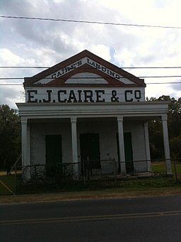
E.J. Caire & Co. | |
| Land | |
|---|---|
| Delstat | Louisiana |
| Parish | Saint John the Baptist Parish |
| Höjdläge | 2 m ö.h. |
| Koordinater | 30°2′36″N 90°33′36″V / 30.04333°N 90.56000°V |
| Yta | 46 km² (2010) |
| - land | 40 km² |
| - vatten | 6 km² |
| Folkmängd | 2 441 (2010) |
| Befolkningstäthet | 61 invånare/km² |
| Tidszon | CST (UTC-6) |
| - sommartid | CDT (UTC-5) |
| ZIP-kod | 70049 |
| Riktnummer | 985 |
| FIPS | 2222815 |
| Geonames | 4323551 |
Ortens läge i Louisiana | |
Louisianas läge i USA | |
Edgard är administrativ huvudort i Saint John the Baptist Parish i Louisiana.[1][2] Vid 2010 års folkräkning hade Edgard 2 441 invånare.[3]
Kända personer från Edgard
- Dave Bartholomew, musiker
Källor
- ^ Louisiana Parish Map with Parish Seat Cities. Geology.com Geoscience News and Information. Läst 31 augusti 2017.
- ^ Edgard, LA. Map Quest. Läst 31 augusti 2017.
- ^ 2010 Census Population of Edgard, Louisiana Arkiverad 31 augusti 2017 hämtat från the Wayback Machine.. Census Viewer. Läst 31 augusti 2017.
|
Media som används på denna webbplats
Shiny red button/marker widget. Used to mark the location of something such as a tourist attraction.
Författare/Upphovsman: Alexrk2, Licens: CC BY 3.0
Den här Det karta skapades med GeoTools.
Författare/Upphovsman: Nolabob, Licens: CC BY-SA 3.0
Caire's General Store along the Great River Road (LA 18) in Edgard, Louisiana
Författare/Upphovsman: This version: uploader
Base versions this one is derived from: originally created by en:User:Wapcaplet, Licens: CC BY 2.0
Map of USA with Louisiana highlighted


