Eatonsville
| Eatonsville | |
| Ort | |
| Land | |
|---|---|
| Delstat | New South Wales |
| Kommun | Clarence Valley |
| Höjdläge | 2 m ö.h. |
| Koordinater | 29°38′00″S 152°50′00″Ö / 29.63333°S 152.83333°Ö |
| Folkmängd | 214 (2021) |
| Tidszon | AEST (UTC+10) |
| - sommartid | AEDT (UTC+11) |
| Geonames | 2167837 |
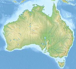
Eatonsville är en ort i Australien.[1] Den ligger i kommunen Clarence Valley och delstaten New South Wales, i den sydöstra delen av landet, omkring 490 kilometer norr om delstatshuvudstaden Sydney. Orten hade 214 invånare år 2021.[2]
Närmaste större samhälle är Grafton, omkring 12 kilometer sydost om Eatonsville.
Källor
- ^ Eatonsville hos GeoNames.Org (cc-by); post uppdaterad 2011-06-04; databasdump nerladdad 2015-12-01
- ^ ”Eatonsville”. Australian Bureau of Statistics Geography. https://www.abs.gov.au/census/find-census-data/quickstats/2021/SAL11373. Läst 18 juli 2022.
Media som används på denna webbplats
Författare/Upphovsman: , Licens: CC BY-SA 3.0
Relief map of Australia, including the borders of the states of the Commonwealth of Australia
Shiny red button/marker widget. Used to mark the location of something such as a tourist attraction.


