East Brookfield
| East Brookfield | |||
| town | |||
Kommunhuset. | |||
| |||
| Land | |||
|---|---|---|---|
| Delstat | Massachusetts | ||
| County | Worcester County | ||
| Höjdläge | 189 m ö.h. | ||
| Koordinater | 42°13′40″N 72°2′48″V / 42.22778°N 72.04667°V | ||
| Yta | 26,9 km² (2020) | ||
| - land | 25,5 km² | ||
| - vatten | 1,4 km² | ||
| Folkmängd | 2 224 (2020) | ||
| Befolkningstäthet | 87 invånare/km² | ||
| Tidszon | EST (UTC-5) | ||
| - sommartid | EDT (UTC-4) | ||
| ZIP-kod | 01515 | ||
| Riktnummer | 508/774 | ||
| FIPS | 2518560 | ||
| Geonames | 4935347 | ||
East Brookfields läge i Massachusetts. | |||
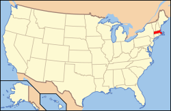
Massachusetts läge i USA | |||
| Webbplats: https://www.eastbrookfieldma.us/ | |||
East Brookfield är en kommun (town) i Worcester County i delstaten Massachusetts, USA.[1] Vid 2020 års folkräkning hade kommunen 2 224 invånare.[2]
Referenser
- ^ ”Town of East Brookfield, Massachusetts” (på engelska). Massachusetts Municipal Association. https://www.mma.org/community/east-brookfield/. Läst 26 september 2024.
- ^ ”Massachusetts Census Data” (på engelska). 2020 Decennial Census. Massachusetts Legislature. https://malegislature.gov/Redistricting/MassachusettsCensusData/CityTown. Läst 26 september 2024.
|
Media som används på denna webbplats
Shiny red button/marker widget. Used to mark the location of something such as a tourist attraction.
Författare/Upphovsman: This version: uploader
Base versions this one is derived from: originally created by en:User:Wapcaplet, Licens: CC BY 2.0
Map of USA with Massachusetts highlighted
Författare/Upphovsman: Pvmoutside, Licens: CC BY-SA 3.0
Easf Brookfield Town Hall
Seal of the Town of East Brookfield
Författare/Upphovsman: Alexrk2, Licens: CC BY 3.0
Location map of Massachusetts, USA
Flag of East Brookfield, Massachusetts


