Dunavecse
| Den här artikeln behöver källhänvisningar för att kunna verifieras. (2018-11) Åtgärda genom att lägga till pålitliga källor (gärna som fotnoter). Uppgifter utan källhänvisning kan ifrågasättas och tas bort utan att det behöver diskuteras på diskussionssidan. |
| Dunavecse | |||
| Stad | |||
| |||
| Land | |||
|---|---|---|---|
| Provins | Bács-Kiskun | ||
| Koordinater | 46°54′50″N 18°58′20″Ö / 46.91375°N 18.97236°Ö | ||
| Yta | 66,77 km² | ||
| Folkmängd | 3 806 (2019)[1] | ||
| Befolkningstäthet | 57 invånare/km² | ||
| Geonames | 3053432 | ||
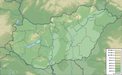
Dunavecses läge i Ungern | |||
| Webbplats: http://www.dunavecse.hu | |||
Dunavecse är en mindre stad i Ungern, med 3 806 invånare 2019.
Den år 2007 invigda Pentelebron över Donau går mellan Dunavecse och Dunaújváros.
Källor
- ^ ”Detailed Gazetteer of Hungary” (på engelska). http://www.ksh.hu/apps/hntr.telepules?p_lang=EN&p_id=07612. Läst 30 maj 2020.
| |||||||||
Media som används på denna webbplats
Författare/Upphovsman: Tkgd2007, Licens: CC BY-SA 3.0
A new incarnation of Image:Question_book-3.svg, which was uploaded by user AzaToth. This file is available on the English version of Wikipedia under the filename en:Image:Question book-new.svg
Shiny red button/marker widget. Used to mark the location of something such as a tourist attraction.
Författare/Upphovsman: Urutseg, Licens: CC0
Hungary physical map, parameters equal to File:Hungary location map.svg
Författare/Upphovsman: Kaboldy, Licens: CC BY-SA 4.0
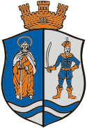
Coats of arms of Dunavecse, Hungary
Författare/Upphovsman: Pisaivó, Licens: CC BY-SA 3.0
Dunavecse, Hungary


