Domažlice
| Domažlice | |||
| Taus | |||
| Stad | |||
Torget i Domažlice | |||
| |||
| Land | |||
|---|---|---|---|
| Region | Plzeň | ||
| Distrikt | Domažlice | ||
| Höjdläge | 428 m ö.h. | ||
| Koordinater | 49°26′26″N 12°55′47″Ö / 49.44056°N 12.92972°Ö | ||
| Area | 24,61 km² | ||
| Folkmängd | 11 163 (1 januari 2016)[1] | ||
| Befolkningstäthet | 454 invånare/km² | ||
| Tidszon | CET (UTC+1) | ||
| - sommartid | CEST (UTC+2) | ||
| Postnummer | 344 01 | ||
| Geonames | 3076587 | ||
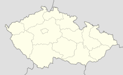
Läge i Tjeckien | |||
Domažlice ([ˈdɔmaʒlɪtsɛ], tyska: Taus) är en stad i Västböhmiska regionen Plzeň, Tjeckien. Staden, som är belägen nära gränsen till Tyskland och vid europaväg E50 har en befolkning som uppgår till 11 163 invånare (1 januari 2016).[1]
Galleri
Referenser
Externa länkar
 Wikimedia Commons har media som rör Domažlice.
Media som används på denna webbplats
Författare/Upphovsman: Lencer, Licens: CC BY-SA 3.0
Location map of the Czech Republic
Shiny red button/marker widget. Used to mark the location of something such as a tourist attraction.
Författare/Upphovsman: Caroig, Licens: CC BY-SA 2.5
Central square in Domažlice, Czechia
Författare/Upphovsman: I would appreciate being notified if you use my work outside Wikimedia.
Do not copy this image illegally by ignoring the terms of the license below, as it is not in the public domain.
More of my work can be found in my personal gallery., Licens: CC BY-SA 4.0Město Domažlice. Průhled Hradskou ulicí od východu k západu. V pozadí věž Chodského hradu.
Författare/Upphovsman: I would appreciate being notified if you use my work outside Wikimedia.
Do not copy this image illegally by ignoring the terms of the license below, as it is not in the public domain.
More of my work can be found in my personal gallery., Licens: CC BY-SA 4.0Město Domažlice. Branská ulice od křižovatky s Hradskou a Vodní ulicí, západní strana směrem k náměstí Míru. Zleva domy čp. 52 (na rohu s Hradskou ulicí), 53 (červený), 54 (hnědý) a 55 (zelený).
Coat-of-arms of the town of Domažlice, Czechia
Författare/Upphovsman: Zirland, Licens: CC BY-SA 2.5
Flag of Domažlice (city in Czechia)
Författare/Upphovsman: I would appreciate being notified if you use my work outside Wikimedia.
Do not copy this image illegally by ignoring the terms of the license below, as it is not in the public domain.
More of my work can be found in my personal gallery., Licens: CC BY-SA 4.0Město Domažlice. Pomník Petra Hany v Hanově parku při ulicích U Nemocnice, 28. října, Sadová a Tyršova na Týnském Předměstí.


