Dolores (olika betydelser)
Dolores kan syfta på:
- Dolores – ett namn samt personer med namnet
- Dolores Recordings – skivbolag
Geografi
Antarktis
- Islotes Dolores, ögrupp, 62°14′00″S 58°26′00″V / 62.23333°S 58.43333°V
Argentina
- Partido de Dolores, kommun, Buenos Aires, 36°25′00″S 57°40′00″V / 36.41667°S 57.66667°V
- Dolores (kommunhuvudort i Argentina), Buenos Aires, 36°18′48″S 57°40′45″V / 36.31321°S 57.67918°V
- Villa Dolores (ort i Argentina, Córdoba), 31°56′45″S 65°11′22″V / 31.94585°S 65.18958°V
- Villa Dolores (ort i Argentina, Catamarca), 28°27′01″S 65°42′56″V / 28.45018°S 65.71548°V
- Concarán, kommunhuvudort, San Luis, 32°33′36″S 65°14′34″V / 32.56009°S 65.2427°V
Colombia
- Rosas (ort i Colombia, Cauca, lat 2,26, long -76,74), 2°15′39″N 76°44′23″V / 2.26093°N 76.73986°V
- Dolores (kommun i Colombia), Tolima, 3°40′00″N 74°45′00″V / 3.66667°N 74.75°V
Filippinerna
- Dolores (Abra), ort och kommun, 17°38′52″N 120°42′33″Ö / 17.6477°N 120.7091°Ö
- Dolores (Quezon), ort och kommun, 14°00′57″N 121°24′04″Ö / 14.0157°N 121.4011°Ö
- Dolores (Östra Samar), ort och kommun, 12°02′14″N 125°28′57″Ö / 12.0371°N 125.4825°Ö
Guatemala
Honduras
- Dolores (kommun i Honduras, Departamento de Copán, lat 14,88, long -88,82), 14°53′00″N 88°49′00″V / 14.88333°N 88.81667°V
- Dolores (ort i Honduras, Departamento de Ocotepeque), 14°32′00″N 89°07′00″V / 14.53333°N 89.11667°V
- Dolores (kommun i Honduras, Departamento de Intibucá), 14°15′00″N 88°20′00″V / 14.25°N 88.33333°V
Mexiko
- Dolores, Angangueo, ort, 19°38′21″N 100°16′19″V / 19.63917°N 100.27194°V
- Las Flores, Guanajuato, ort, Doctor Mora, 21°07′56″N 100°26′51″V / 21.13222°N 100.4475°V
- Dolores, Gómez Palacio, ort, 25°43′20″N 103°33′58″V / 25.72216°N 103.56614°V
- Dolores, Zacatecas, ort, 22°36′00″N 102°19′11″V / 22.60004°N 102.3197°V
- Rancho Nuevo de Dolores, ort, Guanajuato, Irapuato, 20°37′38″N 101°24′53″V / 20.62722°N 101.41472°V
- Dolores, Chiapas, ort, 16°36′16″N 92°30′54″V / 16.60444°N 92.515°V
- Dolores, Susupuato, ort, 19°14′29″N 100°20′44″V / 19.24139°N 100.34556°V
- Dolores, Guerrero, ort, 18°30′54″N 99°36′58″V / 18.515°N 99.61611°V
- Dolores, Lerdo, ort, 25°35′33″N 103°32′58″V / 25.5925°N 103.54944°V
- Dolores, Nuevo León, ort, 23°30′48″N 100°13′55″V / 23.51333°N 100.23194°V
- Dolores, Puebla, ort, San Salvador Huixcolotla, 18°55′25″N 97°45′22″V / 18.92361°N 97.75611°V
Nicaragua
- Dolores (ort i Nicaragua), Carazo, 11°51′22″N 86°12′57″V / 11.85621°N 86.21575°V
Spanien
- Dolores (kommun i Spanien, Valencia, Provincia de Alicante, lat 38,14, long -0,76), 38°08′07″N 0°45′31″V / 38.13537°N 0.7587°V
- Dolores (kommunhuvudort i Spanien, Valencia, Provincia de Alicante, lat 38,14, long -0,77), 38°08′24″N 0°46′15″V / 38.14002°N 0.77088°V
Media som används på denna webbplats
Shiny blue button/marker widget.
Logo for disambiguation pages.
Författare/Upphovsman:
- Guatemala Departments.svg: Daryona
- Mexico location map.svg: NordNordWest
- härlett verk: Spischot
Location map of Guatemala
Författare/Upphovsman: Addicted04, Licens: CC BY-SA 3.0
Location map of Honduras.
Geographic limits of the map:
* West : 269.50 W
* East : 89.00W
* North : 24.00N
* South : 180.00N
Författare/Upphovsman: Alexrk2, Licens: CC BY-SA 3.0
Location map Antarctica, Azimuthal equidistant projection
Författare/Upphovsman: Sémhur, Licens: CC BY-SA 4.0
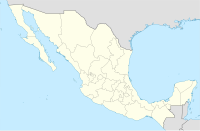
Map of Mexico, with states borders.
Författare/Upphovsman: NordNordWest, Licens: CC BY 3.0
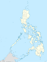
Location map of the Philippines
Författare/Upphovsman: NordNordWest, Licens: CC BY-SA 3.0
Location map of Spain
Equirectangular projection, N/S stretching 130 %. Geographic limits of the map:
- N: 44.4° N
- S: 34.7° N
- W: 9.9° W
- E: 4.8° E
Författare/Upphovsman: NordNordWest, Licens: CC BY-SA 3.0
Location map of Argentina
Författare/Upphovsman: Alexrk2, Licens: CC BY-SA 3.0
Location map of Nicaragua with Departamentos, Equirectangular projection, N/S stretching 100 %. Geographic limits of the map:


