Le Sommet des Diablerets
| Le Sommet des Diablerets | |
| Les Diablerets, Diableret | |
| Bergstopp | |
Le Sommet des Diablerets (i mitten) | |
| Land | |
|---|---|
| Kanton | Valais |
| Distrikt | Conthey |
| Bergskedja | Les Diablerets |
| Höjdläge | 3 216 m ö.h.[1] |
| Koordinater | 46°18′14″N 7°11′21″Ö / 46.30390°N 7.18906°Ö |
| Tidszon | CET (UTC+1) |
| - sommartid | CEST (UTC+2) |
| Geonames | 2661028 |
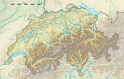
Le Sommet des Diablerets är en bergstopp i Schweiz. Den ligger i distriktet Conthey och kantonen Valais, i den sydvästra delen av landet, 70 km söder om huvudstaden Bern. Toppen på Le Sommet des Diablerets är 3 216 meter över havet.[1] Le Sommet des Diablerets ingår i bergsmassivet Les Diablerets.
Källor
Externa länkar
 Wikimedia Commons har media som rör Le Sommet des Diablerets.
Media som används på denna webbplats
Författare/Upphovsman: Eric Gaba (Sting - fr:Sting) and NordNordWest, Licens: CC BY-SA 3.0
Blank physical map of Switzerland, for geo-location purpose. More maps: → Maps of Switzerland.
Shiny red button/marker widget. Used to mark the location of something such as a tourist attraction.
The summits of Argentine, 2422 m (center left) and Diablerets, 3210 m (background), Vaud Alps. The Col des Essets (2029m) is visible on the right. The Pas de Cheville (2038m) between Vaud and Valais is further on the right, almost not visible on the photo.


