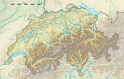
Dent Blanche (bergstopp i Schweiz, Valais)
| Dent Blanche | |
| Bergstopp | |
Dent Blanche | |
| Land | |
|---|---|
| Kanton | Valais |
| Distrikt | Sierre |
| Höjdläge | 4 358 m ö.h. |
| Koordinater | 46°2′3.5″N 7°36′43.1″Ö / 46.034306°N 7.611972°Ö |
| Bredd | 16,9 km |
| Höjd | 1 055 m |
| Tidszon | CET (UTC+1) |
| - sommartid | CEST (UTC+2) |
| Geonames | 2661482 |
Dent Blanche är en bergstopp i Schweiz.[1] Den ligger i distriktet Sierre och kantonen Valais, i den södra delen av landet. Toppen på Dent Blanche är 4 358 meter över havet.[1]
Dent Blanche är den högsta toppen i ett område med 5 km radie. Närmaste större samhälle är Zermatt, 10,7 km öster om Dent Blanche.[1]
Trakten runt Dent Blanche består i huvudsak av kala bergstoppar och isformationer.[2]
Källor
- ^ [a b c] Dent Blanche hos GeoNames.Org (cc-by); post uppdaterad 2010-04-05; databasdump nerladdad 2016-01-03
- ^ ”NASA Earth Observations: Land Cover Classification”. NASA/MODIS. Arkiverad från originalet den 28 februari 2016. https://web.archive.org/web/20160228161657/http://neo.sci.gsfc.nasa.gov/view.php?datasetId=MCD12C1_T1. Läst 30 januari 2016.
Externa länkar
 Wikimedia Commons har media som rör Dent Blanche.
Media som används på denna webbplats
Författare/Upphovsman: Eric Gaba (Sting - fr:Sting) and NordNordWest, Licens: CC BY-SA 3.0
Blank physical map of Switzerland, for geo-location purpose. More maps: → Maps of Switzerland.
Shiny red button/marker widget. Used to mark the location of something such as a tourist attraction.
Författare/Upphovsman: Jérémy Toma, Licens: CC BY-SA 4.0
La Dent Blanche vue depuis les hauteurs des Haudères (VS), en Suisse.


