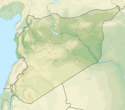
Dara (distrikt i Syrien)
| Den här artikeln har skapats av Lsjbot, ett program (en robot) för automatisk redigering. (2015-11) Artikeln kan innehålla fakta- eller språkfel, eller ett märkligt urval av fakta, källor eller bilder. Mallen kan avlägsnas efter en kontroll av innehållet (vidare information) |
| Dara (منطقة مركز درعا) | |
| Distrikt | |
| Land | |
|---|---|
| Provins | Dara |
| Höjdläge | 573 m ö.h. |
| Koordinater | 32°37′53″N 36°12′13″Ö / 32.63144°N 36.20352°Ö |
| Huvudort | Dara |
| Tidszon | EET (UTC+2) |
| - sommartid | EEST (UTC+3) |
| Geonames | 170904 |
Dara (arabiska: منطقة مركز درعا, منطقة درعا) är ett distrikt i Syrien.[1] Det ligger i provinsen Dara, i den sydvästra delen av landet, 100 kilometer söder om huvudstaden Damaskus.
Källor
- ^ Daraa District hos GeoNames.Org (cc-by); post uppdaterad 2014-02-15; databasdump nerladdad 2015-05-23
Media som används på denna webbplats
Robot icon
Shiny red button/marker widget. Used to mark the location of something such as a tourist attraction.
Författare/Upphovsman:
- Syria_location_map.svg: NordNordWest
- Syria_physical_map.svg: Urutseg
- derivative work: NordNordWest
Physical location map of Syria. De facto situation.
Flag of Syria. Originally flag of the Syria Revolution (from 2011), de facto flag of Syria beginning December 2024, official beginning March 2025.


