Dammastock
| Dammastock | |
| Berg | |
Dammastock från norr. | |
| Land | |
|---|---|
| Kanton | |
| Bergskedja | Urialperna |
| Höjdläge | 3 630 m ö.h. |
| Primärfaktor | 1 466 m |
| Koordinater | 46°38′37″N 8°25′16″Ö / 46.64361°N 8.42111°Ö |
| Bestegs först | Albert Hoffmann-Burkhardt Johann Fischer Andreas von Weissenfluh |
| - datum | 28 juli 1864 |
| Geonames | 2661051 |
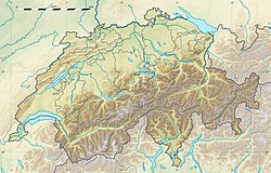
Dammastocks läge i Schweiz. | |
Dammastock (3630 m) är det högsta berget i Uri-alperna, Schweiz. Berget bestegs första gången av Albert Hoffmann-Burkhardt med guiderna Johann Fischer och Andreas von Weissenfluh den 28 juli 1864.
Externa länkar
Referenser
Externa länkar
 Wikimedia Commons har media som rör Dammastock.
Media som används på denna webbplats
Författare/Upphovsman: Eric Gaba (Sting - fr:Sting) and NordNordWest, Licens: CC BY-SA 3.0
Blank physical map of Switzerland, for geo-location purpose. More maps: → Maps of Switzerland.
Shiny red button/marker widget. Used to mark the location of something such as a tourist attraction.
Flag of Canton of Valais (Switzerland). The black contours around the stars and along the division of the field are not usually seen in cantonal flags and are an artefact of this representation reflecting the image used for the pdf of the federal Fahnenreglement of 2007.
Författare/Upphovsman: Cactus26, Licens: CC BY-SA 3.0
Dammastock from north, from Schneestock


