Culpepper Island
| Culpepper Island | |
| Ö | |
Ragged Point fyr på Culpepper Island. | |
| Land | |
|---|---|
| Parish | Saint Philip |
| Koordinater | 13°09′57″N 59°26′36″V / 13.1659°N 59.44333°V |
| Tidszon | AST (UTC-4) |
| Geonames | 3373936 |
Culpepper Island är en ö i Barbados.[1] Den ligger i parishen Saint Philip, i den östra delen av landet.
Ön skapades ursprungligen av koraller.[2]
Källor
- ^ Culpepper Island hos GeoNames.Org (cc-by); post uppdaterad 2015-08-29; databasdump nerladdad 2015-05-11
- ^ Pariser, Harry S. (2000). ”Culpepper Island”. Explore Barbados. Manatee Press. sid. 175. ISBN 9781893643512
Media som används på denna webbplats
Shiny red button/marker widget. Used to mark the location of something such as a tourist attraction.
Författare/Upphovsman: Johnmartindavies, Licens: CC BY-SA 3.0
Eastpoint Lighthouse from the northern end of Cobblers Reef
Författare/Upphovsman: Urutseg, Licens: CC0
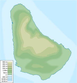
Physical map of Barbados, parameters are equal to Barbados location map.svg


