Coos Bay, Oregon
| Coos Bay, Oregon | |
| Stad (city) | |
| Uppkallad efter: Coos Bay[1] | |
| Land | |
|---|---|
| Delstat | |
| County | Coos County |
| Höjdläge | 7 m ö.h. |
| Koordinater | 43°22′35″N 124°14′14″V / 43.37639°N 124.23722°V |
| Area | 41,16 km² (2010)[5] |
| Folkmängd | 15 985 (2020)[6] |
| Befolkningstäthet | 388 invånare/km² |
| Grundad | 1853[2] |
| Borgmästare | Joe Benetti (2016–)[4] |
| Tidszon | PST (UTC-8) |
| - sommartid | PDT (UTC-7) |
| ZIP-kod | 97420 |
| Riktnummer | 458[3] och 541[3] |
| GNIS-kod | 1166633 |
| Geonames | 5720495 |
Översiktskarta | |
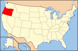
Oregons läge i USA | |
| Wikimedia Commons: Coos Bay, Oregon | |
| Webbplats: http://www.coosbay.org/ | |
| Redigera Wikidata | |

Coos Bay (coos: Atsixiis) är den största staden (city) i Coos County i den amerikanska delstaten Oregon. Staden är belägen vid södra sidan av Coos Bay på Stillahavskusten och hade 15 967 invånare vid 2010 års folkräkning. Orten gränsar till den närbelägna staden North Bend, Oregon och de två städerna med angränsande småorter utgör tillsammans Coos Bay-North Bends tätortsområde.
Referenser
- ^ Lewis A. McArthur, Oregon Geographic Names, sjunde utgåvan, Oregon Historical Society, 2003, ISBN 978-0-87595-278-9.[källa från Wikidata]
- ^ hämtat från: franskspråkiga Wikipedia.[källa från Wikidata]
- ^ [a b] läs online, www.areacodehelp.com.[källa från Wikidata]
- ^ läs online, coosbay.org, läst: 24 juni 2022.[källa från Wikidata]
- ^ United States Census Bureau, 2010 U.S. Gazetteer Files, United States Census Bureau, 2010, läst: 9 juli 2020.[källa från Wikidata]
- ^ United States Census Bureau (red.), USA:s folkräkning 2020, läs online, läst: 1 januari 2022.[källa från Wikidata]
- Den här artikeln är helt eller delvis baserad på material från engelskspråkiga Wikipedia, Coos Bay, Oregon.
Media som används på denna webbplats
Författare/Upphovsman: Huebi, Licens: CC BY 2.0
Map of United States with Oregon highlighted.
Författare/Upphovsman: Ian Poellet, Licens: CC BY-SA 4.0
The historic Chandler Hotel and Annex (built 1909), located at 187 Central Avenue in Coos Bay, Oregon, United States, is listed on the US National Register of Historic Places.
|
This is an image of a place or building that is listed on the National Register of Historic Places in the United States of America. Its reference number is 84002966. |
The Tioga Building in Coos Bay, Oregon, is on the National Register of Historic Places as the Marshfield Hotel.
Flag of Oregon (obverse): The flag was adopted by the state on February 26, 1925.[1] The state seal was decided in 1903.[2][3]
Författare/Upphovsman: Arkyan, Licens: CC BY-SA 3.0
This map shows the incorporated and unincorporated areas in Coos County, Oregon, highlighting Coos Bay in red. It was created with a custom script with US Census Bureau data and modified with Inkscape.


