Confolens
| Confolens | ||
| Kommun | ||
 | ||
| ||
| Land | ||
|---|---|---|
| Region | Nouvelle-Aquitaine | |
| Departement | ||
| Arrondissement | Confolens | |
| Kanton | chef-lieu för Confolens-Nord och Sud | |
| Koordinater | 46°1′N 0°40′Ö / 46.017°N 0.667°Ö | |
| Yta | 23,63 km² | |
| Folkmängd | 2 726 ()[1] | |
| Befolkningstäthet | 115 invånare/km² | |
| Tidszon | CET (UTC+1) | |
| - sommartid | CEST (UTC+2) | |
| Postnummer | 16500 | |
| INSEE | 16106 | |
| Geonames | 6453698 3023919 | |
| OSM-karta | 5811946 | |
 Kommunens läge i regionen Nouvelle-Aquitaine i Frankrike | ||
| Webbplats: http://www.mairie-confolens.fr/ | ||
.svg)

Confolens är en kommun i departementet Charente i regionen Nouvelle-Aquitaine i västra Frankrike. Kommunen är chef-lieu för kantonerna Confolens-Nord och Confolens-Sud och är sous-préfecture för arrondissementet Confolens. År 2022 hade Confolens 2 726 invånare.
Befolkningsutveckling
Antalet invånare i kommunen Confolens
Referens:INSEE[2]
Galleri
 (c) Rigolithe, CC BY-SA 2.5
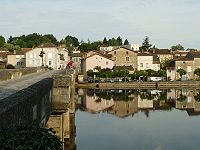
Se även
Källor
- ^ Populations de référence 2022, Institut National de la Statistique et des Études Économiques, 19 december 2024.[källa från Wikidata]
- ^ Chiffres clés - Évolution et structure de la population Arkiverad 5 juli 2012 hämtat från the Wayback Machine.
Media som används på denna webbplats

Författare/Upphovsman: Eric Gaba (Sting - fr:Sting), Licens: CC BY-SA 4.0
Blank physical map of metropolitan France for geo-location purpose.
Scale : 1:14 816 000 (accuracy : about 3,7 km) for the bathymetry. More maps of France, view → Commons Atlas of France.

Shiny red button/marker widget. Used to mark the location of something such as a tourist attraction.
Författare/Upphovsman: Jack ma, Licens: CC BY-SA 3.0
vue de Confolens (Charente, France) depuis la colline Ste-Catherine


Författare/Upphovsman: Jack ma, Licens: CC BY-SA 3.0
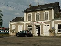
Gare de Confolens (Charente, France)

Författare/Upphovsman: Ingen maskinläsbar skapare angavs. Confolens16 antaget (baserat på upphovsrättsanspråk)., Licens: CC BY 2.5
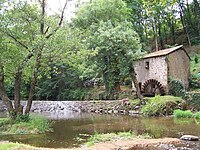
Moulin du Goire à Confolens


Författare/Upphovsman: Jack ma, Licens: CC BY-SA 3.0
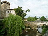
Pont-Vieux, Confolens (Charente, France)
Författare/Upphovsman:
|
Map data (c) OpenStreetMap contributors, CC-BY-SA _French_municipality_map.svg) • Shape files infrastructure: railway, highways, water: all originally by OpenStreetMap contributors. Status december 2011 *note: shown commune boundaries are from OSM dump May 2012; at that time about 90% complete |
Map commune FR insee code 16106.png

Författare/Upphovsman: Jack ma, Licens: CC BY-SA 3.0
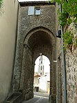
ancien rempart, Confolens (Charente, France)

Författare/Upphovsman: Jack ma, Licens: CC BY-SA 3.0
Pont sur le Goire, Confolens (Charente, France)

(c) Rigolithe, CC BY-SA 2.5
Église Saint Barthélemy de Confolens, Charente, France.