Concepción
Concepción eller Concepcion kan avse:
- Concepción (spanskt fartyg) – ett av Ferdinand Magellans fartyg under den första världsomseglingen
Geografi
Antarktis
- Concepción (udde), 60°30′58″S 45°40′59″V / 60.516°S 45.683°V
Argentina
- Concepción kommun, Argentina, Corrientes, 28°20′00″S 58°00′00″V / 28.33333°S 58°V
- Concepción, Corrientes, 28°23′30″S 57°53′16″V / 28.39175°S 57.88777°V
- Villa Concepción del Tío, ort, Córdoba, 31°19′21″S 62°48′49″V / 31.32259°S 62.81354°V
- Concepción, Catamarca, 28°41′15″S 66°03′59″V / 28.68758°S 66.0664°V
- Concepción, Tucumán, 27°20′29″S 65°35′47″V / 27.34127°S 65.59636°V
Bolivia
- Laguna Concepción (sjö i Bolivia, Beni), 15°27′00″S 64°19′00″V / 15.45°S 64.31667°V
- Concepción, Bolivia, ort, Santa Cruz, 16°07′54″S 62°01′42″V / 16.13155°S 62.02821°V
Chile
- Provincia de Concepción, Chile
- Concepción (kommun i Chile)
- Concepción, Chile, Región del Biobío, Provincia de Concepción, 36°49′37″S 73°02′59″V / 36.82699°S 73.04977°V
Colombia
- Lourdes, Colombia, 7°56′39″N 72°49′57″V / 7.94411°N 72.83253°V
- Concepción kommun, Santander, 6°46′13″N 72°38′04″V / 6.7702°N 72.63437°V
- Concepción, Santander, 6°45′58″N 72°41′38″V / 6.76619°N 72.694°V
- Concepción kommun, Antioquia, 6°25′00″N 75°15′00″V / 6.41667°N 75.25°V
- Concepción, Antioquia, 6°23′39″N 75°15′30″V / 6.39408°N 75.2583°V
- Acevedo (ort), Huila, 1°50′10″N 75°51′18″V / 1.83605°N 75.85498°V
Costa Rica
- Concepción, Costa Rica, Cartago, 9°56′00″N 84°00′00″V / 9.93333°N 84°V
Dominikanska republiken
- Concepción de La Vega – en ort
Ekvatorialguinea
Guatemala
- Municipio de Nueva Concepción (kommun), kommun
- Nueva Concepción, Guatemala, Departamento de Escuintla, 14°12′N 91°18′V / 14.2°N 91.3°V
- Municipio de Concepción Tutuapa, kommun
- Concepción Tutuapa, kommunhuvudort, Departamento de San Marcos, 15°17′00″N 91°47′00″V / 15.28333°N 91.78333°V
- Municipio de Concepción Las Minas, kommun
- Concepción Las Minas, kommunhuvudort, Departamento de Chiquimula, 14°31′00″N 89°27′00″V / 14.51667°N 89.45°V
- Municipio de Concepción Chiquirichapa, kommun
- Concepción Chiquirichapa, kommunhuvudort, Departamento de Quetzaltenango, 14°51′00″N 91°37′00″V / 14.85°N 91.61667°V
- Municipio de Concepción Huista, kommun, Departamento de Huehuetenango, 15°37′00″N 91°41′00″V / 15.61667°N 91.68333°V
- Municipio de Concepción (kommun i Guatemala), Departamento de Sololá, 14°47′00″N 91°09′00″V / 14.78333°N 91.15°V
Filippinerna
- Concepcion (Tarlac), kommun i Tarlac, 15°20′00″N 120°40′00″Ö / 15.33333°N 120.66667°Ö
Honduras
- Concepción kommun, Copán, 14°50′00″N 88°50′00″V / 14.83333°N 88.83333°V
- Concepción kommun, Ocotepeque, 14°30′00″N 89°11′00″V / 14.5°N 89.18333°V
- Concepción kommun, Intibucá, 14°02′00″N 88°20′00″V / 14.03333°N 88.33333°V
Mexiko
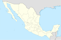
- La Concepción Coatipac, ort, Delstaten Mexiko, Calimaya, 19°10′55″N 99°34′06″V / 19.18188°N 99.56833°V
- Concepción del Bramador, ort, Jalisco, Talpa de Allende, 20°14′41″N 105°04′41″V / 20.2446°N 105.07807°V
- La Concha, Sinaloa, 22°31′57″N 105°27′09″V / 22.5325°N 105.4525°V
- Concepción, La Independencia, 16°13′44″N 91°52′25″V / 16.22889°N 91.87361°V
- Concepción, Calukmuk, Campeche, 18°37′15″N 90°08′00″V / 18.62083°N 90.13333°V
- Concepción, Dzitbalché, Campeche, 20°18′57″N 90°10′53″V / 20.31597°N 90.18126°V
- Concepción, Pantepec, 17°11′01″N 93°03′03″V / 17.18361°N 93.05083°V
Nicaragua
- La Concepción, Nicaragua, Masaya, 11°56′14″N 86°11′23″V / 11.93711°N 86.18976°V
- Cárdenas, Nicaragua, Rivas, 11°11′47″N 85°30′32″V / 11.19639°N 85.5089°V
- Concepción (vulkan), 11°32′18″N 85°37′18″V / 11.53831°N 85.62178°V
Paraguay
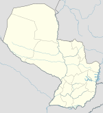
- Concepción (departement), 22°50′00″S 57°10′00″V / 22.83333°S 57.16667°V
- Concepción, Paraguay, departementshuvudort, 23°23′59″S 57°25′56″V / 23.39985°S 57.43236°V
- Concepcion Airport, flygplats, 23°26′30″S 57°25′38″V / 23.44175°S 57.42712°V
Media som används på denna webbplats
Författare/Upphovsman: Alexrk2, Licens: CC BY-SA 3.0
Location map Antarctica, Azimuthal equidistant projection
Shiny blue button/marker widget.
Logo for disambiguation pages.
Författare/Upphovsman:
- Guatemala Departments.svg: Daryona
- Mexico location map.svg: NordNordWest
- härlett verk: Spischot
Location map of Guatemala
Författare/Upphovsman: NordNordWest, Licens: CC BY-SA 3.0
Location map of Paraguay
Författare/Upphovsman: Addicted04, Licens: CC BY-SA 3.0
Location map of Honduras.
Geographic limits of the map:
* West : 269.50 W
* East : 89.00W
* North : 24.00N
* South : 180.00N
Författare/Upphovsman: NordNordWest, Licens: CC BY-SA 3.0
Location map of Chile
Författare/Upphovsman: Sémhur, Licens: CC BY-SA 4.0
Map of Mexico, with states borders.
Författare/Upphovsman: NordNordWest, Licens: CC BY 3.0
Location map of the Philippines
Författare/Upphovsman: Alexrk2, Licens: CC BY-SA 3.0
Location map Dominican Republic with Provinces, Equirectangular projection, N/S stretching 105 %. Geographic limits of the map:
(c) Eric Gaba – Wikimedia Commons user: Sting, CC BY-SA 4.0
Blank map of Costa Rica for geo-location purpose.
Note: The Isla del Coco, out of the map, is not shown.
Scale: 1:1,856,000 (accuracy: 464 m).
Equirectangular projection centered on 9°30'N – 84°15'W, WGS84 datum
Geographic limits of the map:
* West: 86°30'W
* East: 82°W
* North: 11°30'N
* South: 7°30'N
Författare/Upphovsman: NordNordWest, Licens: CC BY-SA 3.0
Location map of Bolivia
(c) Karte: NordNordWest, Lizenz: Creative Commons by-sa-3.0 de
Location map of Equatorial Guinea
Författare/Upphovsman: NordNordWest, Licens: CC BY-SA 3.0
Location map of Argentina
Författare/Upphovsman: Alexrk2, Licens: CC BY-SA 3.0
Location map of Nicaragua with Departamentos, Equirectangular projection, N/S stretching 100 %. Geographic limits of the map:


