Cleveland Heights
| Cleveland Heights | |
| Stad (city) | |
| Land | |
|---|---|
| Delstat | |
| County | Cuyahoga County |
| Höjdläge | 285 m ö.h. |
| Koordinater | 41°30′35″N 81°33′48″V / 41.50972°N 81.56333°V |
| Area | 21,04 km² (2010)[2] |
| Folkmängd | 45 312 (2020)[3] |
| Befolkningstäthet | 2 153 invånare/km² |
| Grundad | 1903[1] |
| Tidszon | EST (UTC-5) |
| - sommartid | EDT (UTC-4) |
| ZIP-kod | 44118 |
| Riktnummer | 216 |
| GNIS-kod | 1048605 |
| Geonames | 4833320 |
Översiktskarta | |
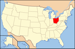
Ohios läge i USA | |
| Wikimedia Commons: Cleveland Heights, Ohio | |
| Webbplats: http://www.clevelandheights.gov | |
| Redigera Wikidata | |
Cleveland Heights är en ort i Cuyahoga County i delstaten Ohio, USA.
Referenser
- ^ hämtat från: engelskspråkiga Wikipedia.[källa från Wikidata]
- ^ United States Census Bureau, 2010 U.S. Gazetteer Files, United States Census Bureau, 2010, läst: 9 juli 2020.[källa från Wikidata]
- ^ United States Census Bureau (red.), USA:s folkräkning 2020, läs online, läst: 1 januari 2022.[källa från Wikidata]
Media som används på denna webbplats
Författare/Upphovsman: Tim Evanson, Licens: CC BY-SA 2.0
1912-1926 S. Taylor Road in Cleveland Heights, Ohio. This mixed-use building, also known as one of the "Tudor Taylors", is part of the Stadium Park National Historic District. This three-story rectangular Tudor Revival "block" was designed by Maxwell H. Weis. Benjamin D. Roseman began construction on the $175,000 building probably in the fall of 1927, and it was completed in February 1928. It had eight retail units on the first floor and 16 apartment units on the second and third floors.
Författare/Upphovsman: Rcsprinter123, Licens: CC BY 3.0
Map showing the location of this city within Cuyahoga County, Ohio. Data source: 2010 U.S. census
Författare/Upphovsman: This version: uploader
Base versions this one is derived from: originally created by en:User:Wapcaplet, Licens: CC BY 2.0
Map of USA with Ohio highlighted


