Cleveland (olika betydelser)
Cleveland kan syfta på:
- Cleveland (efternamn) – ett efternamn samt personer med namnet
- Cleveland Publishing, Australien
- 6296 Cleveland – en asteroid
Geografi
Australien
- Cleveland, Queensland, förort till Brisbane, Redland City, 27°31′36″S 153°15′55″Ö / 27.52677°S 153.26516°Ö
Kanada
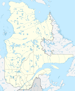
- Cleveland, Québec, kommun i Estrie, 45°40′00″N 72°04′57″V / 45.66678°N 72.0824°V
Storbritannien
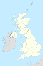
- Cleveland (högland), England, 54°29′00″N 0°55′00″V / 54.48333°N 0.91667°V
- Cleveland, England, område och före detta grevskap (1974–1996) i nordöstra England.
USA
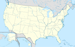
- Cleveland, huvudort i Cuyahoga County, Ohio, 41°29′58″N 81°41′43″V / 41.4995°N 81.69541°V
- Cleveland, Alabama, ort, Blount County, 33°59′27″N 86°34′39″V / 33.99093°N 86.57749°V
- Cleveland, Florida, ort, Charlotte County, 26°57′42″N 81°59′02″V / 26.96173°N 81.98398°V
- Cleveland, Georgia, huvudort i White County, 34°35′49″N 83°45′48″V / 34.59704°N 83.76324°V
- Cleveland, Missouri, ort, Cass County, 38°40′45″N 94°35′37″V / 38.67918°N 94.59357°V
- Cleveland, Mississippi, huvudort i Bolivar County, 33°44′38″N 90°43′29″V / 33.744°N 90.72482°V
- Cleveland, North Carolina, ort, Rowan County, 35°44′00″N 80°40′37″V / 35.7332°N 80.67701°V
- Cleveland, Oklahoma, ort, Pawnee County, 36°18′37″N 96°27′57″V / 36.31032°N 96.46584°V
- Cleveland, Tennessee, huvudort i Bradley County, 35°09′34″N 84°52′36″V / 35.15952°N 84.87661°V
- Cleveland, Texas, ort i Liberty County, 30°20′29″N 95°05′08″V / 30.34132°N 95.08549°V
- Cleveland, Virginia, ort, Russell County, 36°56′37″N 82°09′06″V / 36.94372°N 82.1518°V
- Cleveland, Illinois, ort, Henry County, 41°30′22″N 90°18′53″V / 41.50615°N 90.31485°V
- Cleveland, Minnesota, ort, Le Sueur County, 44°19′32″N 93°50′16″V / 44.32552°N 93.83773°V
- Cleveland, New York, ort, Oswego County, 43°14′25″N 75°53′02″V / 43.24035°N 75.8838°V
- Cleveland, Wisconsin, ort, Manitowoc County, 43°54′54″N 87°44′50″V / 43.91499°N 87.74731°V
- Cleveland, Utah, ort, Emery County, 39°20′56″N 110°51′06″V / 39.34886°N 110.85155°V
Media som används på denna webbplats
Författare/Upphovsman: NordNordWest, Licens: CC BY-SA 3.0
Location map of Australia
Shiny blue button/marker widget.
(c) Karte: NordNordWest, Lizenz: Creative Commons by-sa-3.0 de
Location map of the United Kingdom
Författare/Upphovsman: TUBS
Location map of the USA (Hawaii and Alaska shown in sidemaps).
Main map: EquiDistantConicProjection : Central parallel :
* N: 37.0° N
Central meridian :
* E: 96.0° W
Standard parallels:
* 1: 32.0° N
* 2: 42.0° N
Made with Natural Earth. Free vector and raster map data @ naturalearthdata.com.
Formulas for x and y:
x = 50.0 + 124.03149777329222 * ((1.9694462586094064-({{{2}}}* pi / 180))
      * sin(0.6010514667026994 * ({{{3}}} + 96) * pi / 180))
y = 50.0 + 1.6155950752393982 * 124.03149777329222 * 0.02613325650382181
      - 1.6155950752393982  * 124.03149777329222 *
     (1.3236744353715044  - (1.9694462586094064-({{{2}}}* pi / 180))
      * cos(0.6010514667026994 * ({{{3}}} + 96) * pi / 180))
Hawaii side map: Equirectangular projection, N/S stretching 107 %. Geographic limits of the map:
- N: 22.4° N
- S: 18.7° N
- W: 160.7° W
- E: 154.6° W
Alaska side map: Equirectangular projection, N/S stretching 210.0 %. Geographic limits of the map:
- N: 72.0° N
- S: 51.0° N
- W: 172.0° E
- E: 129.0° W
Shiny red button/marker widget. Used to mark the location of something such as a tourist attraction.
Logo for disambiguation pages.
Författare/Upphovsman: NordNordWest, Licens: CC BY-SA 3.0
Location map of Quebec, Canada


