Clay Cross
| Clay Cross | |
| Stad | |
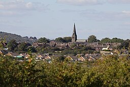
Vy över Clay Cross | |
| Land | |
|---|---|
| Riksdel | England |
| Region | East Midlands |
| Ceremoniellt grevskap | Derbyshire |
| Administrativt grevskap | Derbyshire |
| Distriktkt | North East Derbyshire |
| Koordinater | 53°09′55″N 01°24′48″V / 53.16528°N 1.41333°V |
| Area | 4,83 km²[1] |
| Folkmängd | 12 925 (2011)[1] |
| Befolkningstäthet | 2 676 invånare/km² |
| Tidszon | WET (UTC+0) |
| - sommartid | BST (UTC+1) |
| Postort | CHESTERFIELD |
| Postnummer | S45 |
| Riktnummer | 01246 |
| Geonames | 2652911 7294861 |
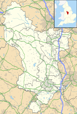
Contains Ordnance Survey data © Crown copyright and database right, CC BY-SA 3.0 Clay Cross läge i Derbyshire | |
| Webbplats: www.claycross.gov.uk | |
Clay Cross är en stad och civil parish i grevskapet Derbyshire i England. Staden ligger i distriktet North East Derbyshire, cirka 8 kilometer söder om Chesterfield. Tätortsdelen (built-up area sub division) Clay Cross hade 12 925 invånare vid folkräkningen år 2011.[1]
Referenser
- ^ [a b c] ”Clay Cross Built-up area sub division - Local Area Report - Nomis”. www.nomisweb.co.uk. https://www.nomisweb.co.uk/reports/localarea?compare=E35001303. Läst 23 juli 2020.
Externa länkar
 Wikimedia Commons har media som rör Clay Cross.
Media som används på denna webbplats
Shiny red button/marker widget. Used to mark the location of something such as a tourist attraction.
Författare/Upphovsman: Phil Sangwell from United Kingdom, Licens: CC BY 2.0
Just to prove that by choosing the right angle and using foreground hedges to mask out "The Bronx" even Claycross can be made to look picture postcard.....!!
Contains Ordnance Survey data © Crown copyright and database right, CC BY-SA 3.0
Map of Derbyshire, UK with the following information shown:
- Administrative borders
- Coastline, lakes and rivers
- Roads and railway station are
- Urban areas
Equirectangular map projection on WGS 84 datum, with N/S stretched 165%
Geographic limitation :
- West: 2.06W
- East: 1.10W
- North: 53.55N
- South: 52.69N


