Clarkstown
| Clarkstown | |
| town | |
Polisbricka i bruk i Clarkstown. | |
| Land | |
|---|---|
| Delstat | New York |
| County | Rockland County |
| Höjdläge | 32 m ö.h. |
| Koordinater | 41°7′34″N 73°58′49″V / 41.12611°N 73.98028°V |
| Yta | 121,91 km² (2020) |
| - land | 99,63 km² |
| - vatten | 22,28 km² |
| Folkmängd | 86 859 (2020) |
| Befolkningstäthet | 872 invånare/km² |
| Grundad | 1791 |
| Tidszon | EST (UTC-5) |
| - sommartid | EDT (UTC-4) |
| Riktnummer | 845 |
| FIPS | 3615968 |
(c) NordNordWest, CC BY 3.0 Ortens läge i delstaten New York | |
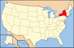
New Yorks läge i USA | |
Clarkstown är en kommun (town) i Rockland County i delstaten New York. Countyts huvudort New City ingår i Clarkstown.[1] Vid 2020 års folkräkning hade Clarkstown 86 859 invånare.[2] Kommunen grundades 1791 och den ingick i Orange County tills Rockland County grundades 1798.[3]
Källor
- ^ Clarkstown, NY. Map Quest. Läst 26 januari 2020.
- ^ Clarkstown town, Rockland County, New York. City and Town Population Totals, 2020-2021. United States Census Bureau. Läst 10 maj 2023.
- ^ Town of Clarkstown Arkiverad 3 april 2016 hämtat från the Wayback Machine.. Rockford Group. Läst 26 januari 2020.
Media som används på denna webbplats
(c) NordNordWest, CC BY 3.0
Location map of the State of New York, USA
Shiny red button/marker widget. Used to mark the location of something such as a tourist attraction.
Författare/Upphovsman: Huebi, Licens: CC BY 2.0
Map of USA with New York highlighted
Författare/Upphovsman: Richard Avery, Licens: CC BY-SA 3.0
Embroidered badge of Clarkstown Police Department, NY State, cleaned.


