Clark County, Nevada
| Clark County | |
| County | |
Valley of Fire State Park | |
| Land | |
|---|---|
| Delstat | |
| Huvudort | Las Vegas |
| Area | 20 877 km² (2010)[1] |
| - land | 20 439 km² (98%) |
| - vatten | 439 km² (2%) |
| Folkmängd | 1 951 269 (2010)[2] |
| Befolkningstäthet | 95 invånare/km² |
| Grundat | 1908 |
| - uppkallat efter | William A. Clark |
| Tidszon | PST (UTC-8) |
| - sommartid | PDT (UTC-7) |
| FIPS-kod | 32003 |
| Geonames | 5501879 |
 Läge i delstaten Nevada. | |
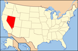
Delstatens läge i USA. | |
| Webbplats: www.clarkcountynv.gov | |
Clark County är ett administrativt område i delstaten Nevada, USA. År 2010 hade countyt 1 951 269 invånare, vilket gör Clark County till det i särklass mest befolkade countyt i delstaten Nevada. Då countyt har haft en mycket kraftig befolkningsökning de senaste decennierna uppskattade United States Census Bureau att countyt år 2009 hade en befolkning på drygt 1,9 miljoner.[3]
Den administrativa huvudorten (county seat) är Las Vegas.
Geografi
Enligt United States Census Bureau har countyt en total area på 20 956 km². 20 487 km² av den arean är land och 466 km² är vatten.
Hooverdammen, Harry Reid International Airport samt både Creech och Nellis Air Force Base är belägna i countyt.
Angränsande countyn
- Lincoln County, Nevada - nord
- Nye County, Nevada - väst
- Inyo County, Kalifornien - sydväst
- San Bernardino County, Kalifornien - syd
- Mohave County, Arizona - öst
Städer
Byar (urval)
Se även
Källor
- ^ ”2010 Census U.S. Gazetteer Files for Counties”. U.S. Census Bureau. Arkiverad från originalet den 5 juli 2012. https://www.webcitation.org/68vYLbou5?url=http://www.census.gov/geo/www/gazetteer/files/Gaz_counties_national.txt. Läst 5 juli 2012.
- ^ ”State & County QuickFacts, Clark County, Nevada” (på engelska). U.S. Census Bureau. Arkiverad från originalet den 8 juli 2011. https://www.webcitation.org/601ksgctO?url=http://quickfacts.census.gov/qfd/states/32/32003.html. Läst 6 juli 2011.
- ^ ”American FactFinder - T1. Population Estimates [11”]. United States Census Bureau. Arkiverad från originalet den 16 februari 2020. https://archive.today/20200216034011/http://factfinder.census.gov/servlet/DTTable?_bm=y&-context=dt&-ds_name=PEP_2009_EST&-CONTEXT=dt&-mt_name=PEP_2009_EST_G2009_T001&-tree_id=809&-redoLog=true&-_caller=geoselect&-geo_id=05000US32003&-search_results=05000US06037&-format=&-_lang=en. Läst 17 januari 2011.
Externa länkar
- www.clarkcountynv.gov
 Wikimedia Commons har media som rör Clark County.
| ||||||||||
Media som används på denna webbplats
Flag of the State of Nevada. The flag is described in Nevada Revised Statutes Chapter 235, Sec. 20 as follows: The body of the flag must be of solid cobalt blue. On the field in the upper left quarter thereof must be two sprays of Sagebrush with the stems crossed at the bottom to form a half wreath. Within the sprays must be a five-pointed silver star with one point up. The word “Nevada” must also be inscribed below the star and above the sprays, in a semicircular pattern with the letters spaced apart in equal increments, in the same style of letters as the words “Battle Born.” Above the wreath, and touching the tips thereof, must be a scroll bearing the words “Battle Born.” The scroll and the word “Nevada” must be golden-yellow. The lettering on the scroll must be black-colored sans serif gothic capital letters.
Författare/Upphovsman: This version: uploader
Base versions this one is derived from: originally created by Wapcaplet, Licens: CC BY 2.0
Locator map of Nevada — in the Western United States.
Författare/Upphovsman: Clément Bardot, Licens: CC BY-SA 3.0
La Vallée du Feu dans l'état du Nevada
This is a locator map showing Clark County in Nevada. For more information, see Commons:United States county locator maps.


