Clarendon, Texas
| Clarendon | |
| city | |
(c) User: (WT-shared) Mistoffeles at wts wikivoyage, CC BY-SA 4.0 Saints' Roost Museum. | |
| Land | |
|---|---|
| Delstat | Texas |
| County | Donley County |
| Höjdläge | 833 m ö.h. |
| Koordinater | 34°56′16″N 100°53′18″V / 34.93778°N 100.88833°V |
| Yta | 7,8 km² (2010) |
| - land | 7,5 km² |
| - vatten | 0,3 km² |
| Folkmängd | 2 026 (2010) |
| Befolkningstäthet | 270 invånare/km² |
| Tidszon | CST (UTC-6) |
| - sommartid | CDT (UTC-5) |
| ZIP-kod | 79226 |
| Riktnummer | 806 |
| FIPS | 4815112 |
| Geonames | 5519031 |
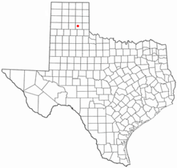
Ortens läge i Texas | |
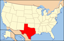
Texas läge i USA | |
Clarendon är administrativ huvudort i Donley County i Texas.[1][2] Enligt 2010 års folkräkning hade Clarendon 2 026 invånare.[3] Orten har sitt ursprung i vad som kallades av grundarna "kristen koloni" och grundades 1878 av metodistprästen Lewis Henry Carhart och hans svärson W.A. Allen.[4]
Kända personer från Clarendon
- Mac Thornberry, politiker
Källor
- ^ Texas County Map with County Seat Cities. Geology.com Geoscience News and Information. Läst 23 augusti 2016.
- ^ Profile for Clarendon, Texas. ePodunk. Läst 23 augusti 2016.
- ^ 2010 Census Population of Clarendon, Texas Arkiverad 28 augusti 2016 hämtat från the Wayback Machine.. Census Viewer. Läst 23 augusti 2016.
- ^ Clarendon, TX. Handbook of Texas Online. Läst 23 augusti 2016.
|
Media som används på denna webbplats
(c) User: (WT-shared) Mistoffeles at wts wikivoyage, CC BY-SA 4.0
Location: Saint's Roost Museum.
Författare/Upphovsman: This version: uploader
Base versions this one is derived from: originally created by en:User:Wapcaplet, Licens: CC BY 2.0
Map of USA with Texas highlighted
Författare/Upphovsman: The original uploader was Seth Ilys på engelska Wikipedia., Licens: CC-BY-SA-3.0
Adapted from Wikipedia's TX county maps by Seth Ilys.


