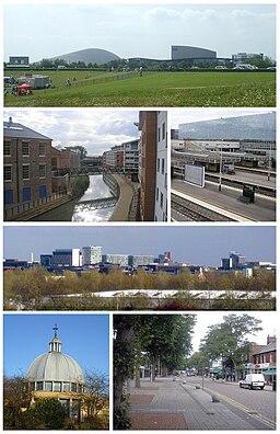
City of Milton Keynes
| City of Milton Keynes | |
| Milton Keynes | |
| Enhetskommun | |
| Land | |
|---|---|
| Riksdel | England |
| Ceremoniellt grevskap | Buckinghamshire |
| Huvudort | Milton Keynes |
| Area | 309 km²[1] |
| Folkmängd | 292 180 (2022)[2] |
| Tidszon | UTC (UTC+0) |
| - sommartid | BST (UTC+1) |
| GSS-kod | E06000042 |
Contains Ordnance Survey data © Crown copyright and database right, CC BY-SA 3.0 Läge i grevskapet Buckinghamshire | |
| Webbplats: https://www.milton-keynes.gov.uk/ | |
City of Milton Keynes är en enhetskommun i Buckinghamshire i England, Storbritannien. Kommunen har 292 180 invånare (2022)[2]. Huvudort är Milton Keynes.
Hela kommunen är indelad i civil parishes:
- Abbey Hill, Astwood, Bletchley and Fenny Stratford, Bow Brickhill, Bradwell, Broughton, Calverton, Campbell Park, Castlethorpe, Central Milton Keynes, Chicheley, Clifton Reynes, Cold Brayfield, Emberton, Fairfields, Gayhurst, Great Linford, Hanslope, Hardmead, Haversham-cum-Little Linford, Kents Hill, Monkston and Brinklow, Lathbury, Lavendon, Little Brickhill, Loughton & Great Holm, Milton Keynes, Moulsoe, New Bradwell, Newport Pagnell, Newton Blossomville, North Crawley, Old Woughton, Olney, Ravenstone, Shenley Church End, Shenley Brook End, Sherington, Simpson and Ashland, Stantonbury, Stoke Goldington, Stony Stratford, Tyringham and Filgrave, Walton, Warrington, Wavendon, West Bletchley, Weston Underwood, Whitehouse, Woburn Sands, Wolverton and Greenleys och Woughton on the Green.[3]
Referenser
- ^ ”Estimates of the population for the UK, England, Wales, Scotland, and Northern Ireland (Mid-2022)” (på engelska) (xls). Landyta, avrundad till hela km². Office for National Statistics. 26 mars 2024. https://www.ons.gov.uk/peoplepopulationandcommunity/populationandmigration/populationestimates/datasets/populationestimatesforukenglandandwalesscotlandandnorthernireland. Läst 25 juni 2024.
- ^ [a b] ”Estimates of the population for the UK, England, Wales, Scotland, and Northern Ireland (Mid-2022)” (på engelska) (xls). Office for National Statistics. 26 mars 2024. https://www.ons.gov.uk/peoplepopulationandcommunity/populationandmigration/populationestimates/datasets/populationestimatesforukenglandandwalesscotlandandnorthernireland. Läst 25 juni 2024.
- ^ ”Ordnance Survey linked data”. Ordnance Survey. http://data.ordnancesurvey.co.uk/doc/7000000000038413. Läst 26 juni 2016.
Externa länkar
 Wikimedia Commons har media som rör Milton Keynes.
| ||||||||||||||||||||||||||
Media som används på denna webbplats
Författare/Upphovsman: Tom walker, Licens: CC BY 3.0
A montage of images of Milton Keynes.
Contains Ordnance Survey data © Crown copyright and database right, CC BY-SA 3.0
Map of Buckinghamshire, UK with Milton Keynes highlighted.
Equirectangular map projection on WGS 84 datum, with N/S stretched 160%


