Chlumec u Chabařovic
| Chlumec | |||
| Kulm | |||
| Stad | |||
| |||
| Land | |||
|---|---|---|---|
| Indelning | Ústí nad Labem | ||
| Distrikt | Ústí nad Labem | ||
| Höjdläge | 235 m ö.h. | ||
| Koordinater | 50°41′59″N 13°56′23″Ö / 50.69972°N 13.93972°Ö | ||
| Yta | 12,88 km² | ||
| Folkmängd | 4 423 (1 januari 2016)[1] | ||
| Befolkningstäthet | 343 invånare/km² | ||
| Tidszon | CET (UTC+1) | ||
| - sommartid | CEST (UTC+2) | ||
| Postnummer | 400 10 till 403 39 | ||
| Geonames | 3077754 | ||
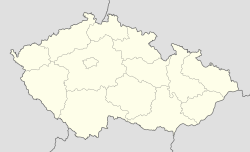
Läge i Tjeckien | |||
Chlumec (tyska: Kulm) är en stad i Tjeckien, 12 kilometer nordöst om Teplice. Per den 1 januari 2016 hade staden 4 423 invånare.[1]
Chlumec var 29-30 augusti 1813 skådeplats för slaget vid Kulm.
Referenser
Vidare läsning
- Carlquist, Gunnar, red (1933). Svensk uppslagsbok. Bd 16. Malmö: Svensk Uppslagsbok AB. sid. 262
Externa länkar
 Wikimedia Commons har media som rör Chlumec.
Media som används på denna webbplats
Shiny red button/marker widget. Used to mark the location of something such as a tourist attraction.
Coat of arms of the municipality Chlumec (Ústí nad Labem District), approved by the local authority 2011-09-07
Författare/Upphovsman: Lencer, Licens: CC BY-SA 3.0
Location map of the Czech Republic
Bezejmenné hlavní náměstí podél Krušnohorské ulice v Chlumci u Ústí nad Labem.
Flag of the municipality Chlumec (Ústí nad Labem District), approved by the local authority 2011-09-07


