Chester, South Carolina
| Chester | |
| city | |
Alice Graham Smith House | |
| Land | |
|---|---|
| Delstat | South Carolina |
| County | Chester County |
| Höjdläge | 163 m ö.h. |
| Koordinater | 34°42′17″N 81°12′51″V / 34.70472°N 81.21417°V |
| Yta | 8,5 km² (2010) |
| - land | 8,5 km² |
| - vatten | 0,0 km² |
| Folkmängd | 5 607 (2010) |
| Befolkningstäthet | 660 invånare/km² |
| Tidszon | EST (UTC-5) |
| - sommartid | EDT (UTC-4) |
| ZIP-kod | 29706 |
| FIPS | 4514095 |
| Geonames | 4574565 |
Ortens läge i South Carolina | |
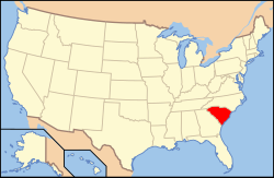
South Carolinas läge i USA | |
| Webbplats: http://chestersc.org/ | |
Chester är administrativ huvudort i Chester County i South Carolina.[1] Orten har fått sitt namn efter Chester i Pennsylvania.[2][3]
Källor
- ^ South Carolina County Map with County Seat Cities. Geology.com Geoscience News and Information. Läst 17 maj 2016.
- ^ Profile for Chester, South Carolina. ePodunk. Läst 17 maj 2016.
- ^ Chester County History Arkiverad 23 juni 2016 hämtat från the Wayback Machine.. Chester County Chamber of Commerce. Läst 17 maj 2016.
|
Media som används på denna webbplats
Shiny red button/marker widget. Used to mark the location of something such as a tourist attraction.
Författare/Upphovsman: JHughesTurner, Licens: CC BY-SA 4.0
Mrs Smiths original mansion was built in 1819. It was purchased by her husband in 1882 as they were being married. After the death of her husband and grand daughter, Mrs Smith had the original mansion rolled off its foundation to the rear of her property and erected this more modern, more functional home in the same location.
Författare/Upphovsman: This version: uploader
Base versions this one is derived from: originally created by en:User:Wapcaplet, Licens: CC BY 2.0
Map of USA with South Carolina highlighted
Författare/Upphovsman: Alexrk, Licens: CC BY 3.0
Den här Det karta skapades med GeoTools.


